

| |
|
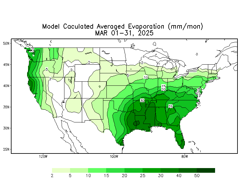
| Supplemental Information |
Last Week's Supplemental Information |
Water in the Earth System Information
| Earth System | Atmospheric Info | Oceanic Info | Terrestrial Info | Extras |
| NASA Earth from Space | USGS Earthshots |
| ASTER Satellite Picture Gallery | NASA Earth Observatory |
| Map Symbol Explanation | Additional Atmospheric Links | Back to Top |
| Chapter Photographs | |||||||||||
| 1 | 2 | 3 | 4 | 5 | 6 | 7 | 8 | 9 | 10 | 11 | 12 |
| What is WES? | WES LITs | NSES |
| Atmospheric Terms | Oceanographic Terms | Hydrologic Terms |
| US Map - West, East | World Map | Blank US Map |
| AMS Glossary | Educational Links | AMS Education Materials |
| Back to Top |

© Copyright 2005: American Meteorological Society