Weekly Ocean News
PREVIEW WEEK: 23-27 January 2017
Items of Interest:
- Welcome ocean science educators to the annual AMS meeting -- The 97th annual meeting of the American Meteorological Society (AMS) is being held this week (22 - 26 January) in Seattle, WA. The theme for this year's AMS meeting is "Observations Lead the Way," stressing the need for observations to obtain the information needed by meteorologists and those in allied disciplines. One of the numerous symposia and conferences that will be conducted at the meeting is the 26th Symposium on Education, where educators from kindergarten through university levels will be attending workshops or giving presentations on weather, ocean, climate and space science education issues.
- Worldwide GLOBE at Night 2017 Campaign is underway -- The first in the series of GLOBE at Night citizen-science campaigns for 2017 will continue through Saturday, 28 January. GLOBE at Night is a worldwide, hands-on science and education program designed to encourage citizen-scientists worldwide to record the brightness of their night sky by matching the appearance of a constellation (Orion in both the Northern and Southern Hemispheres) with the seven magnitude/star charts of progressively fainter stars.
Activity guides are also available. The GLOBE at night program is intended to raise public awareness of the impact of light pollution.
The next series in the 2017 campaign is scheduled for 18-27 February 2017. [GLOBE at Night]
- Ocean charts, units, location and time -- Please
read this week's Supplemental
Information…In Greater Depth for a description of a several
types of oceanographic charts along with the definitions of some units
commonly used in ocean science to locate positions on the Earth's
surface and to identify time.
Ocean in the News:
- Eye on the tropics --- The weather remained relatively quiet last week across the tropical and subtropical ocean basins in both the Northern and Southern Hemispheres. The only weather system of note was a tropical depression, or an area of low pressure with surface winds of less than 39 mph that had formed over the western North Pacific basin
during the previous week. Some thunderstorms were also a part of the tropical depression. Being the first tropical depression of 2017 in the western North Pacific, it was identified as Tropical Depression 1W (or TD 1W). Although TD 1W had weakened over the previous weekend after passing across the Philippines, it strengthened as it moved across the South China Sea toward the Vietnam coast at the start of last week. TD 1W finally dissipated after it made landfall to the south-southeast of Ho Chi Minh City, Vietnam early in the week. The NASA Hurricane Page has additional information and satellite imagery for TD 1W.
- A new National Estuarine Research Reserve in Hawaii is designated -- NOAA's National Ocean Service announced this past week a new National Estuarine Research Reserve in Hawaii which is the 29th in the system. This 1385-acre He'eia National Estuarine Research Reserve, which is be managed in partnership with the State of Hawaii through the University of Hawaii's Hawaii Institute of Marine Biology, is located within the Kāneohe Bay estuary on the windward side of Oahu and is intended to protect a section of the estuary and provide a living laboratory to explore and understand the important areas where rivers meet the sea. [NOAA News]
- New regional sea level scenarios designed to help communities prepare -- Using local data, new regional sea level scenarios have been developed for the nation by NOAA and its partners to provide coastal communities plan for and adapt to the risk of rising sea levels. These scenarios are in a report entitled "Global and Regional Sea Level Rise Scenarios for the United States." [NOAA News]
- Fisheries disasters for nine West Coast species is declared -- Last week the outgoing U.S. Secretary of Commerce Penny Pritzke determined that commercial fisheries disasters had occurred in nine salmon and crab fisheries in Alaska, California and Washington, the result of sudden and unexpected large decreases in fish stock biomass due to unusual ocean and climate conditions. This decision enables fishing communities in these three states to seek disaster relief assistance from Congress.
[NOAA Fisheries Newsroom]
- Higher water temperatures along West Coast increase risk of toxic shellfish -- Scientists from Oregon State University, the Oregon Department of Fish and Wildlife and NOAA National Marine Fisheries Service have discovered a high correlation between higher water temperatures offshore of Oregon and Washington and high levels of domoic acid, a shellfish toxin, in shellfish collected from these waters. The higher ocean temperatures are attributed to climate change. The research team has also produced a climate-based model, which predicts the time and location of domoic acid levels in Oregon and Washington shellfish that could exceed public safety limits. [NOAA NCCOS News]
- Jason-3 satellite celebrates one year anniversary -- One year ago last week, the Jason-3 (for the third Joint Altimetry Satellite Oceanography Network) satellite was successfully launched into a low Earth orbit with an altitude of approximately 830 miles above the Earth's surface. Jason-3 satellite joins its predecessor Jason-2 in continuing to make ocean surface height measurements using onboard radar altimeters, which were first made from space by the TOPEX/Poseidon mission in 1992. In addition to monitoring sea surface height over time for assessing climate change, Jason-3 collects data on wave height and ocean winds. [NOAA NESDIS News]
- Satellites help rescue 307 people in 2016.-- During last year (2016), 307 people were rescued from life-threatening situations throughout the US and on its surrounding waters in part because of the role that NOAA's fleet of operational satellites played. Approximately two-thirds of those rescued (205) involved waterborne rescues. The 307 people that were rescued represent the largest annual total since the 357 rescued in 2007. By detecting distress signals from emergency beacons, these NOAA satellites helped pinpoint the location of these people and relay this information to first responders who perform the actual rescue. NOAA's geosynchronous and polar-orbiting satellites are part of the international COSPAS-SARSAT (COSPAS a Russian abbreviation for "Space System for the Search of Vessels in Distress" and SARSAT "Search and Rescue Satellite Aided Tracking") system. [NOAA NESDIS News]
- Building global connections with the US Marine Biodiversity Network -- NOAA has been developing the U.S. Marine Biodiversity Network (MBON) that is intended to not only help scientists notice changes in biodiversity of marine ecosystems at locations around the nation, but also have the tools in place to better understand what these changes indicate about global ocean health over time. Furthermore, scientists involved with MBON have been cultivating relationships with marine biodiversity networks around the world, including the Group on Earth Observations Biodiversity Observing Network (GEO BON), the Biology and Ecosystems Panel of the Global Ocean Observing System, the Ocean Biogeographic Information System, and the Marine Biodiversity Observation Network of the Group on Earth Observations Biodiversity Observation Network. [NOAA National Ocean Service News]
- Slow-growing Alaskan coral could make important fish habitat to recover more slowly to changing climate -- In a five-year study, scientists at NOAA Fisheries' Alaska Fisheries Science Center have discovered that one species of Alaskan coral can take 60 years to grow to full size and may grow even more slowly in a warming ocean. These coral, located off the southeast coast of Alaska, provide a refuge for fish, but can be injured by disturbances from a changing climate and fishing activity. [NOAA Fisheries Alaska Fisheries Science Center News]
- Satellite sees ash cloud develop over Alaskan volcano -- An image produced from data collected last week by the Moderate Resolution Imaging Spectroradiometer (MODIS) onboard NASA's Terra satellite reveals a plume of ash and condensate emanating from a partially submerged volcano on Bogoslof Island in Alaska's Aleutian Island chain. Some of the volcanic material was reported to have reached nearly 35,000 feet (10 km). [NASA Earth Observatory]
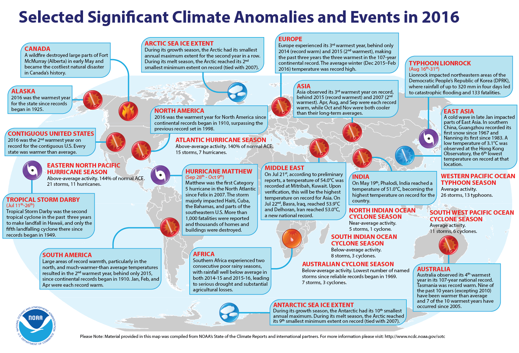
- Global weather and climate for 2016 reviewed -- Scientists at NOAA's National Centers for Environmental Information (NCEI) reported that
based upon their preliminary analysis of worldwide land and ocean
surface temperature data, the calendar year of 2016 was the warmest since sufficiently detailed world-wide climate records began in 1880. The average global temperature across land and ocean surface areas for 2016 was 1.69 Fahrenheit degrees above the 20th century (1901-2000) average of 57.0 degrees Fahrenheit), exceeding the previous record temperature departure set in 2015 by 0.07 Fahrenheit degrees. The scientists attributed the record global temperature to record warm oceans. When considered separately, annually-averaged temperature for ocean surfaces in 2016 was 1.35 Fahrenheit degrees higher than the 20th century average, which set a record high departure.
A near-record strong El Niño event (an anomalous
atmospheric and oceanic circulation regime favoring warm or cool waters in the
equatorial Eastern Pacific Ocean) commencing in late 2015 and continuing into 2016 contributed to the record warmth of the near-surface waters of the global oceans. The global land surface temperature for 2016 was 2.57 Fahrenheit degrees above the 20th century average,
which surpassed the previous annual land record set in 2015.
The
Arctic sea ice remained well below the long-term averages that cover the period of record beginning in 1979 when satellite surveillance of the polar ice caps began. During the winter growth season, the sea ice covering the Arctic experienced its smallest annual maximum extent, while at the end of the summer melt season, the sea ice tied 2007 for the second smallest minimum summer extent on record. Sea ice extent around Antarctica also was below average. During the winter growth season, the ice around that content reached the tenth smallest annual maximum extent for the satellite period, while during the summer melt season, the ice extent was the ninth smallest minimum on record.
The scientists also note that the preliminary global precipitation data
from land-based stations indicate 2016 a complex pattern, with many areas experiencing extreme drought because of below to much below average precipitation, while other land areas of the planet were exceptionally wet. [NOAA/NCEI
State of the Climate]
NCEI also provides a map showing the Global Significant Weather and Climate Events map for 2016.
Using data from essentially the same number of stations, but a slightly different methodology for averaging global surface
temperatures, scientists at NASA's Goddard Institute for Space Studies
(GISS) reported that the global average temperature for 2016 also was the
highest reading since 1880. [NASA
GISS] In a joint news conference held last Wednesday, the director of NASA GISS and the Chief of the Monitoring Branch of NCEI announced their findings that are summarized in graphical format on 14 slides. [NOAA/NASA Press Briefing]
A 15-second animated loop of global temperature anomaly maps showing the spatial distribution of the differences between observed and 20th century average temperatures was generated for each year from 1880 through 2016. An animation is also available in mp4 format. [NOAA Climate.gov News]
A blog was written
by a contractor for NCEI examining the statistical likelihood of the occurrence of a record high global temperature in three consecutive years or from 2014 through 2016.
[NOAA Climate.gov News]
NCEI also produced a summary of the global weather and climate for December 2016.
The December 2016 globally-averaged temperature across both land and ocean surfaces was 1.42 Fahrenheit degrees above the 20th century average, which represents the third highest temperature departure for the month since 1880, falling behind the December 2015 and December 2014 readings. The December 2016 surface temperature averaged across the global oceans was the fourth highest global ocean temperature on record, while the monthly temperature for the land surface ranked as the sixth highest December global land temperature. [NOAA/NCEI
State of the Climate]
- Higher global temperatures could cause temporary increase in lake effect snows along Great Lakes -- A meteorologist with the National Oceanic and Atmospheric Administration (NOAA) Climate Prediction Center wrote feature article for the NOAA ClimateWatch Magazine explaining the apparent paradox that exists concerning an increase in lake effect snowfall along the downwind sides of the Great Lakes over recent decades even though global air temperatures have been increasing. Maps and satellite images showing the regions where lake effect snow are provided. [NOAA News]
- An All-Hazards Monitor -- This Web portal provides the user information from NOAA's National Weather Service, FAA and FEMA on
current environmental events that may pose as hazards such as tropical
weather, fire weather, marine weather, severe weather, drought and
floods. [NOAA/NWS Daily Briefing]
- Earthweek -- Diary of the Planet [earthweek.com]
Concept of the Week: Touring the
DataStreme Ocean RealTime Ocean Portal Website
Welcome to DataStreme Ocean! You are embarking on a study of
the world ocean and the role of the ocean in the Earth system. This
unique teacher enhancement course focuses on the flow and
transformations of energy and water into and out of the ocean, the
internal properties and circulation of the ocean, interactions between
the ocean and the other components of the Earth system, and the
human/societal impacts on and responses to those interactions.
Throughout this learning experience, you will be using the RealTime Ocean Portal to access and interpret a variety of
environmental information, including recent observational data. The
objective of this initial Concept of the Week is to
explore features of the RealTime Ocean Portal website.
On Monday of each week of the course, we will post the current Weekly Ocean News that includes Ocean in
the News (a summary listing of recent events related to the
ocean), Concept of the Week (an in-depth analysis
of some topic related to the ocean in the Earth system), and Historical
Events (a list of past events such as tsunamis or specific
advances in the understanding of oceanography). When appropriate, a
feature called Supplemental Information-In Greater Depth will be provided on some topic related to the principal theme of the
week.
You will use the RealTime Ocean Portal to
access and download the weekly "Current Ocean Studies" that complement Investigations found in your Ocean
Studies Investigations Manual. These materials should be
available Monday morning. Click the appropriate links to download and
print these electronic Current Ocean Studies and answer forms as well
as your Chapter Progress and Investigations Response forms.
The body of the RealTime Ocean Portal provides
links to the Earth System, information on Physical & Chemical,
Geological, and Biological aspects of the ocean, Atmosphere/Ocean
Interaction, the Great Lakes, and extras-a glossary of terms, maps and
educational links. Following each section is a link to other sites that
examine the various subsystems of the Earth system. Let's take a quick
tour to become more familiar with the RealTime Ocean Portal.
Under Physical & Chemical, click
on Sea
Surface Temperatures. This image uses a color scale
to depict the global pattern of sea surface temperatures (SSTs) (in
degrees Celsius) averaged over a recent 7-day period and based on
measurements by infrared sensors onboard Earth-orbiting satellites.
(Depending on your browser, you may have to place your mouse cursor on
the slide bar to the right and scroll down to view the entire image.)
Compare SSTs in the Northern Hemisphere with those in the Southern
Hemisphere. Return to the RealTime Ocean Portal.
Under Geological, click on Current
Earthquake Activity. The USGS Current World
Seismicity page provides a global map of the locations of seismic
(earthquake) events color-coded for the past seven days. The size of
the squares represents the magnitude of recent earthquakes. Note how
earthquakes are concentrated along the margin of the Pacific Ocean.
Details of recent earthquakes can be found by clicking on their map
squares. Return to the RealTime Ocean Portal.
The ocean is home to a wide variety of habitats and organisms.
Under Biological, click on Ocean
"Color" (Productivity). This is
a satellite-derived (SeaWiFS) color-coded map of biological
productivity in the surface waters of the world ocean is averaged from
October 1978 to date. Orange and red indicates the highest
productivity, while dark blue and violet indicate the lowest
productivity. Note the vast areas of relatively low productivity over
the central regions of the subtropical ocean basins. Individual months
within this period may be chosen for viewing. Now return to the RealTime Ocean Portal.
Under Atmosphere/Ocean Interaction, click
on TRMM/GPM
Tropical Rainfall. The TRMM/GPM (Tropical
Rainfall Measuring Mission) page includes color-coded maps of
the Monthly Mean Rainrate (in mm per day) across the tropics for the
last 30 days ending on the present date. Changes in rainfall are linked
to large-scale shifts in the atmosphere/ocean circulation in the
tropics. Now return to the RealTime Ocean Portal.
Take a few minutes when you have time to browse the other data
and information sources available via the RealTime Ocean Portal. Return frequently to learn more about the many resources on
the ocean in the Earth system. Bon voyage!
Concept of the Week: Questions
- The latest global sea surface temperature map indicates
that SSTs are generally higher over the [(western)(eastern)] tropical Pacific Ocean.
- The USGS map of Current Earthquake Activity indicates that
earthquakes appear to be more common along the [(east)(west)] coast of North America.
Historical Events
- 23 January 1622...William Baffin, the English explorer who
sought the Northwest Passage as a route around the northern coast of
North America, died at an estimated age of 38 during the war between
the Shah of Persian and the Portuguese. In 1615, he explored what is
now known as Baffin Bay, coming within 800 miles of the North Pole. His
voyages were made with scientific care, determining latitudes, and
observing tides. With records made of his compass needle, he made the
first magnetic chart. He was the first to attempt a determination of
longitude by observing the moon. (Today in Science History)
- 23 January 1960... The Trieste, a specially constructed submersible bathyscaphe, descended to a
depth of 35,810 feet in the Pacific Ocean called the Challenger Deep,
the deepest point known to exist on Earth, in the Marianas Trench near
Guam. (Today in Science History)
-
26 January 1700...The Cascadia Earthquake (magnitude 9) took place off the coast of British Columbia, as evidenced by Japanese records. Landslides and a tsunami destroyed many Native American villages along the coasts of Washington, Oregon and British Columbia, including Vancouver Island. Japanese written history tells of a massive tsunami striking fishing villages the next day along the coast of Honshu, killing hundreds. (Wikipedia) (Today in Science History)
- 26 January 1983...The California coast was battered by a storm, which produced record high tides, thirty-two foot waves, and mudslides, causing millions of dollars in damage. The storm then moved east and dumped four feet of snow on Lake Tahoe. (22nd-29th) (The Weather Channel)
- 28 January 1946...Canada's greatest sailing ship, Bluenose,
foundered on a Haitian reef; all hands were saved. Her likeness remains
on the Canadian ten-cent coin. (Wikipedia)
- 28 January 1969...A series of storms that battered Southern
California from the 18th to the 28th led to $125 million damage in the Los Angeles Basin, along with
approximately 9 storm and traffic-related deaths in California. Twenty
feet of water covered Sherman Island, a region that contains more than
10,000 dike-protected agricultural acres, when a dike failed. (Accord's
Weather Guide Calendar)
- 28 January 1971...A waterspout swept into Hawaii's Kailua
Bay, then into the business and hotel district of Kailua-Kona,
destroying or severely damaging a number of buildings including 40
apartment units and collapsing a 6-story hotel under construction.
Amazingly, only four people were injured. (Accord's Weather Guide
Calendar)
- 29-30 January 1966...A hurricane that struck Samoa was
responsible for 50 deaths, destroyed more than one-third of the homes
and damaged the remainder. As many as 50,000 people were left homeless.
Swains Island was leveled by the hurricane. Winds gusted to 100 mph at
Pago Pago. (Accord's Weather Guide Calendar)
- 29 January 1983...A series of Pacific coast storms finally
came to an end. The storms, attributed in part to the anomalous
ocean-atmosphere phenomenon, "El Niño," produced ocean swells 15 to 20
feet high that ravaged the beaches of southern California. Much of the
damage was to homes of movie stars in the exclusive Malibu Colony. (The
Weather Channel)
Return to RealTime Ocean Portal
Prepared by DS Ocean Central Staff and Edward J. Hopkins,
Ph.D.,
email hopkins@aos.wisc.edu
© Copyright, 2017, The American Meteorological Society.