Wisconsin Climate Watch
February 2023 and Winter 2022-2023 Wisconsin Climate Summary
Steve Vavrus, PhD, State Climatologist
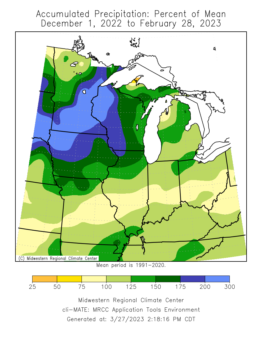
Wet, wetter, and wettest
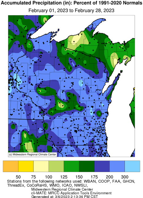
February was remarkably wet across all of Wisconsin, landing in 5th place on record (back to 1895). As shown in the map of precipitation anomalies, virtually the entire state experienced exceptionally wet conditions. All nine of Wisconsin's climate divisions reported more than 200% of normal precipitation in February.
Another noteworthy aspect of the month's unusual wetness was an extremely heavy rainfall event on the 27th, which brought copious amounts of rain throughout the state but especially high in the far south. Both Milwaukee and Madison recorded more precipitation on that day (2.06" and 1.56", respectively) than normally falls there during the entire month of February. Such days are extremely rare, recurring in any month only once every four to six years on average. This also happened to be Milwaukee's wettest February day on record (dating back to 1871) and the only time it has received two or more inches on a single calendar day during February. Fortunately, damage was limited by the absence of a deep snowpack, but there was still street flooding and some wet basements around the city.
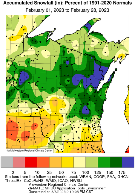
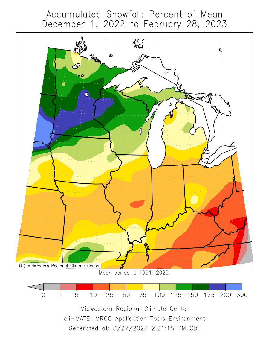
Snowfall amounts remained exceptionally high in northern and east-central regions, helping to bolster the deep snowpack that has been entrenched in northwest Wisconsin (and Minnesota) since December.
On the wet side
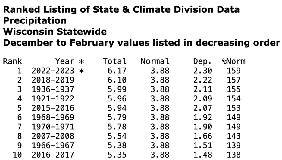
Winter (December-February) was even more exceptional, in that the winter of 2022-23 was Wisconsin's wettest meteorological winter on record (since 1895). Most of that was caused by our soggy February, but both January (24th place) and December (14th place) had considerably more precipitation than normal. As shown below, Wisconsin was not alone in experiencing a very wet winter, as a surprisingly active and persistent storm track produced abundant rain and snow from California to the Upper Midwest. However, only the Badger state recorded an all-time high in the 128 years of data collection nationally. Interestingly, half of Wisconsin's 10 wettest winters on record have occurred since 2007-08, consistent with projections that winter and spring will show the largest seasonal precipitation increases in the future.
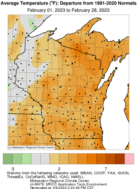
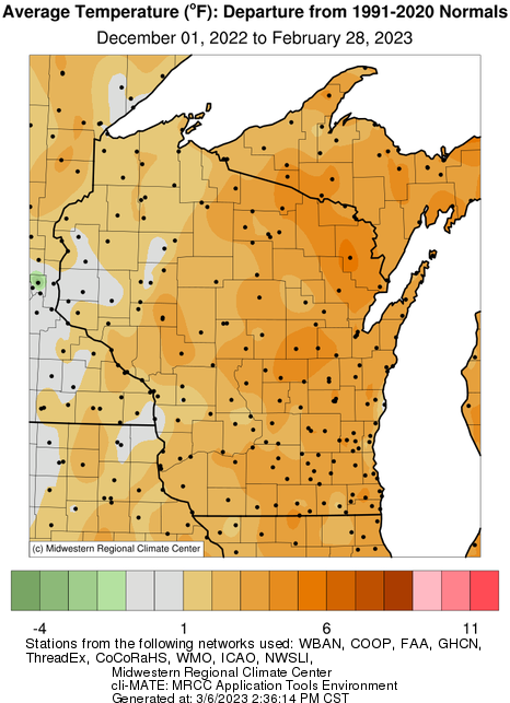
A warm February and winter
Although temperatures didn't come close to record-breaking, both February and the winter were unusually warm. The month ranked 20th all time, registering 2.6 degrees above the 1991-2020 average, and winter landed in a tie for 14th place (2.7 degrees above normal), which places it nearly among the 10% of warmest Wisconsin winters. Only December was abnormally cold statewide (2.3 degrees below normal), but that was more than countered by January being 7.7 degrees above average. The unusual warmth was most pronounced in the eastern half of the state, and the far northeast had the largest positive temperature anomalies in both February and winter.
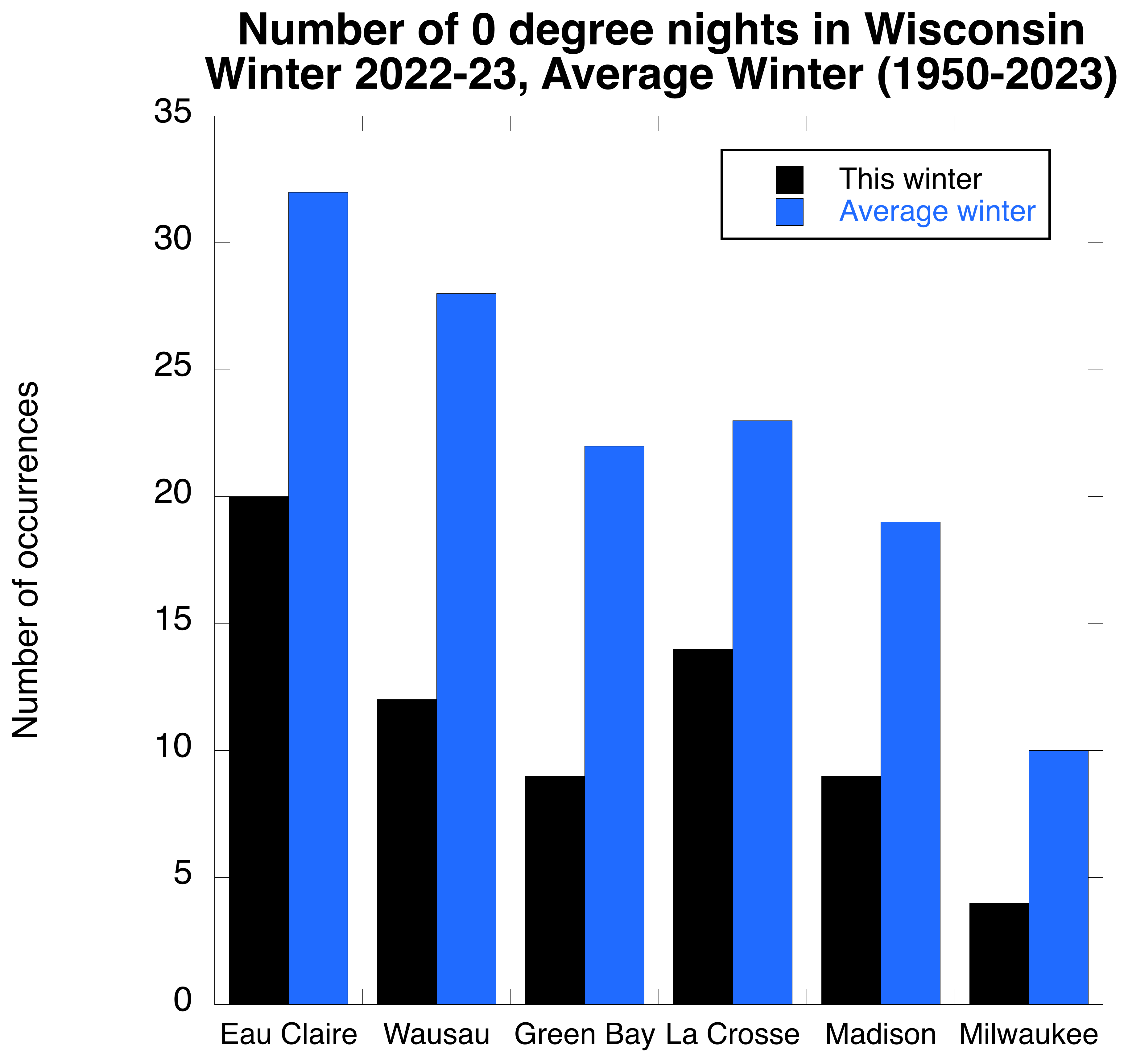
One consequence of these warm overall conditions was a scarcity of extreme cold this winter. As shown below, all six "first-order" weather stations across Wisconsin (Eau Claire, Wausau, Green Bay, La Crosse, Madison and Milwaukee) were far below their usual number of nights at or below 0 degrees between December and February.
|