Wisconsin Climate Watch
January 2023 Wisconsin Climate Summary
Steve Vavrus, PhD, State Climatologist
Warm and gloomy
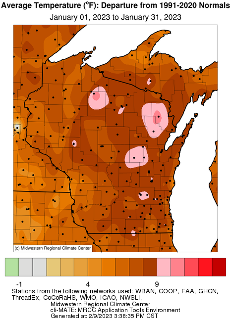
2023 began with an extremely warm start to the year in Wisconsin, with the state-wide average temperature of 23.0 degrees being 7.7 degrees higher than the long-term average (1895 to present). This anomaly put the month as the 5th warmest January on record, and the daily minimum temperatures were even more extreme: 2nd warmest in the 129 years of data. All parts of the state were exceptionally warm, ranging from 8 to 11 degrees above normal, but far north-central and northeast Wisconsin had the largest anomalies of all.
On the wet side
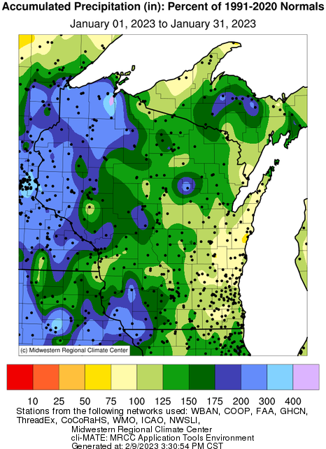
January was also wetter than normal in Wisconsin (37% above average statewide) but not exceptionally so (27th wettest on record). Virtually all portions of the state received more precipitation than average, except for slightly dry anomalies in the east-central region.
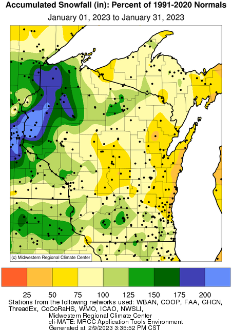
For snow enthusiasts, January all depended on which part of the state you live in. During much of the month, a diagonal line from southwest to northeast Wisconsin represented the snow margin, with a deep snowpack in the northwest but mostly bare ground southeast of this boundary. A late-month snowstorm hitting southern Wisconsin on the 28th finally brought snow cover to the entire state to close out the month, but otherwise January's snowfall was fairly meager in the central and eastern portions of the state.
Oh, drear!
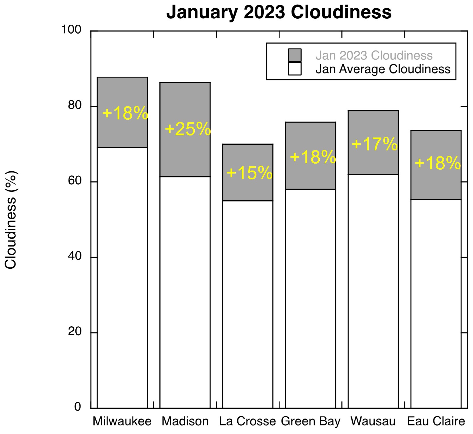
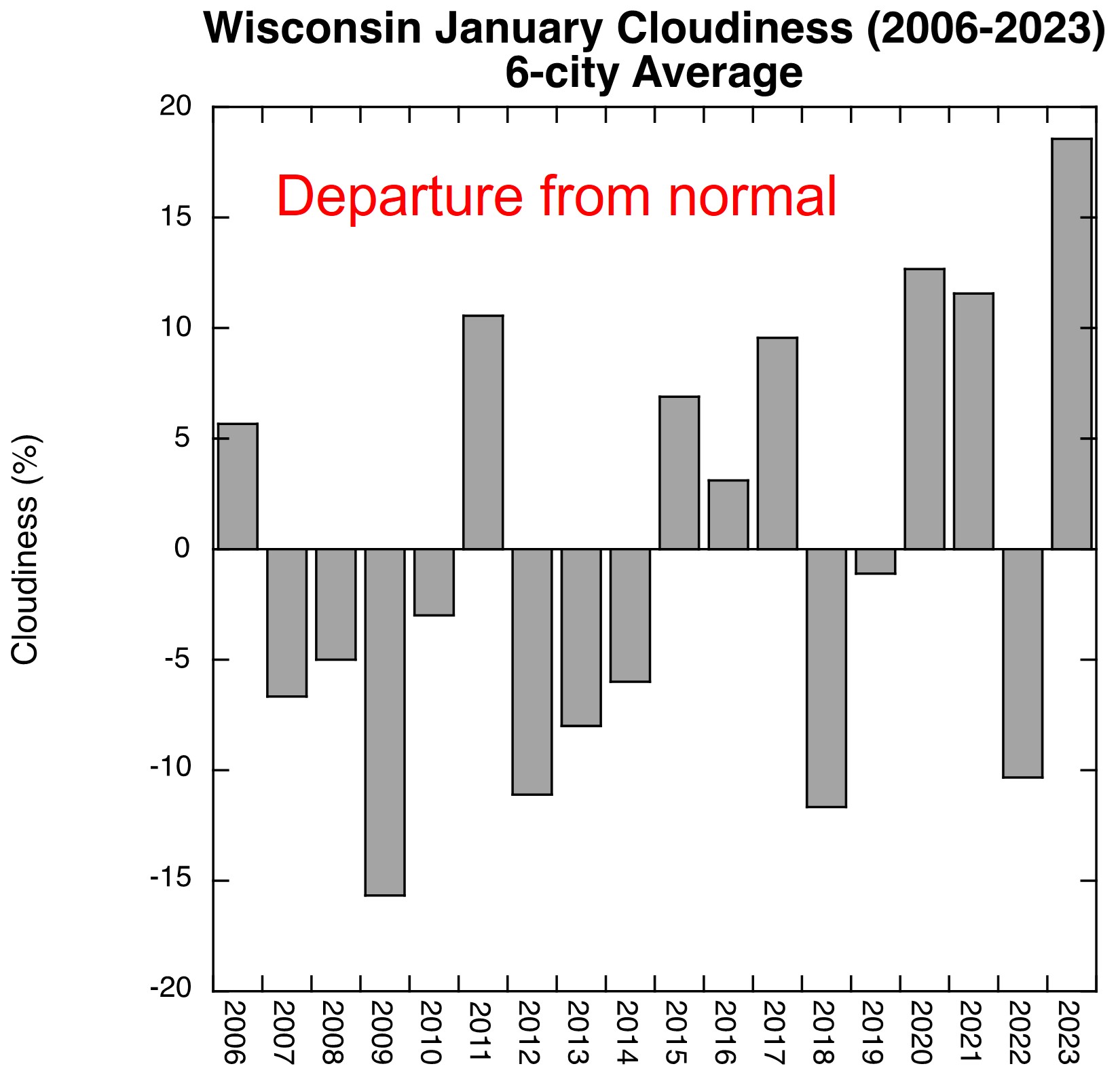
Besides the extreme warmth, the most remarkable aspect of January was the seemingly relentless cloudiness. Based on daily sky conditions (sunrise to sunset) reported by the National Weather Service, all six of the "first-order" weather stations around Wisconsin reported at least 70% sky cover in January, exceeding average conditions by 15 to 25 percentage points. Compared with all Januaries for data available back to 2006, January was the cloudiest in all these cities except La Crosse, which ranked second.
The gloominess was most extreme in the far south and east, where Milwaukee suffered through clouds 88% of the time while Madison was nearly as high (86.5%) and had the largest positive anomaly of 25%. To top it off, fog was reported on 24 of Madison's 31 January days! Averaged across all six cities, last month was by far Wisconsin's cloudiest January in the 18 years of data (sky coverage 79% of the time = 18% above normal).
|