Wisconsin Climate Watch
June 2023 Wisconsin Climate Summary
Steve Vavrus, PhD, State Climatologist
Dryness continues from May through June
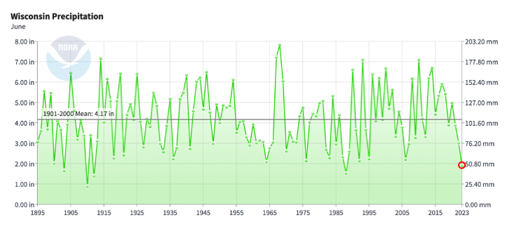
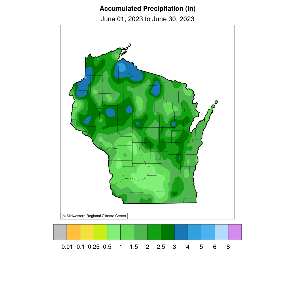
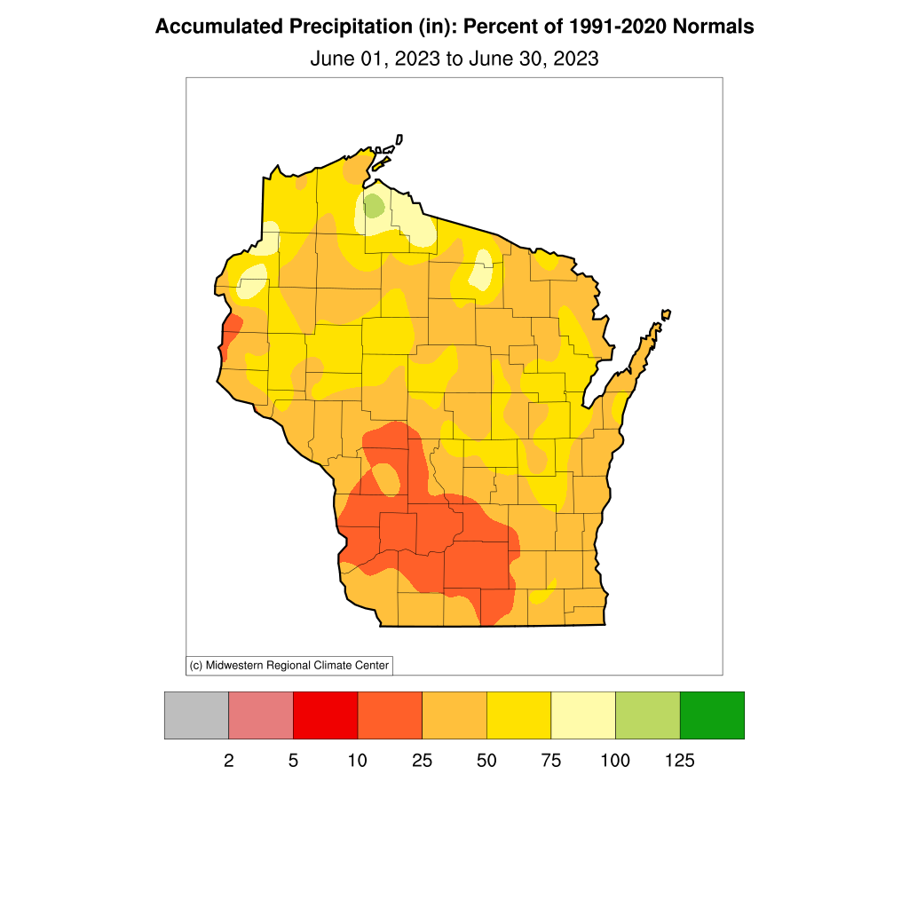
Drought conditions emerged rapidly in Wisconsin during June. On the heels of the 4th driest May on record (since 1895), June followed suit in becoming the 5th driest on record with only 1.91 inches of rain averaged statewide. The last June that was this dry occurred back in 1988 and before that in 1912---more than a century ago! As in May, virtually all of Wisconsin was unusually dry during June, but the most arid region was the south-central and southwest, where many locations received less than 25% of normal rainfall. In fact, it was the driest June on record in Richland and Sauk Counties and the second-driest June in Dane and Columbia Counties. The combination of Wisconsin's extreme rainfall deficit each of the past two months meant that the state endured its third driest May-June period on record.
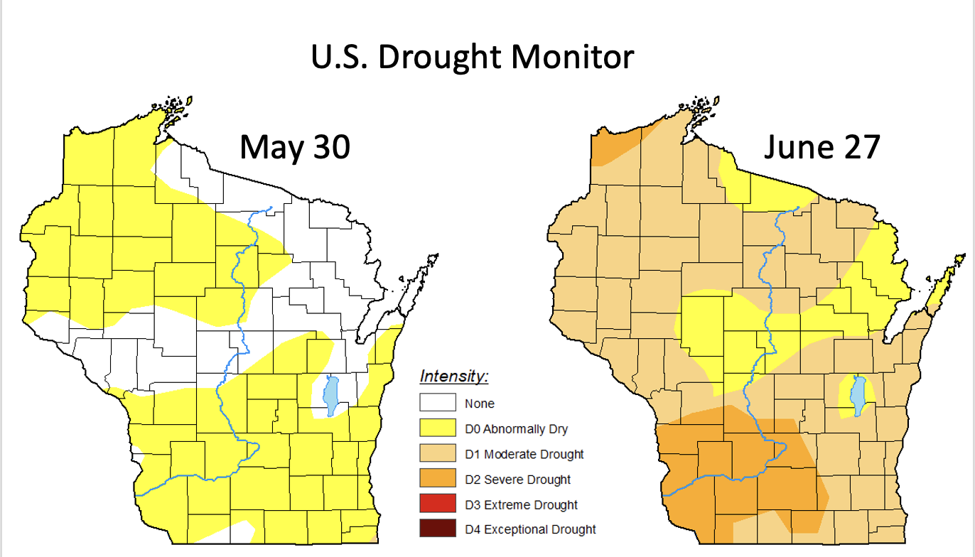
This very sudden transition to persistently dry weather resulted in the emergence of "flash drought" conditions during June. A flash drought is distinguished by its rapid onset, which was especially noteworthy after Wisconsin just experienced its wettest start to a year on record (January-April). The sudden emergence of drought is starkly illustrated below by the U.S. Drought Monitor. It showed only abnormally dry conditions and no drought at the end of May, but by the end of June there was moderate drought over most of Wisconsin, and 1/6 of the state was in severe drought.
 |
 |
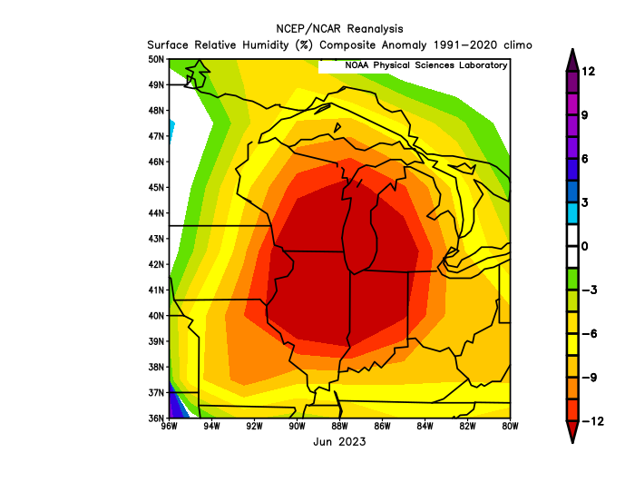
The flash drought was initiated not only by inadequate rainfall but also by exceptionally dry air masses that began in May and continued through June. The moisture content of the air was extremely low during June over a broad area of the Midwest centered on Wisconsin, Illinois, Michigan, and Indiana. The average monthly relative humidity was more than 12% below normal over this region, due to unusually frequent winds blowing from Canada that blocked the usual influx of moist air from the Gulf of Mexico.
Cough, wheeze, gag
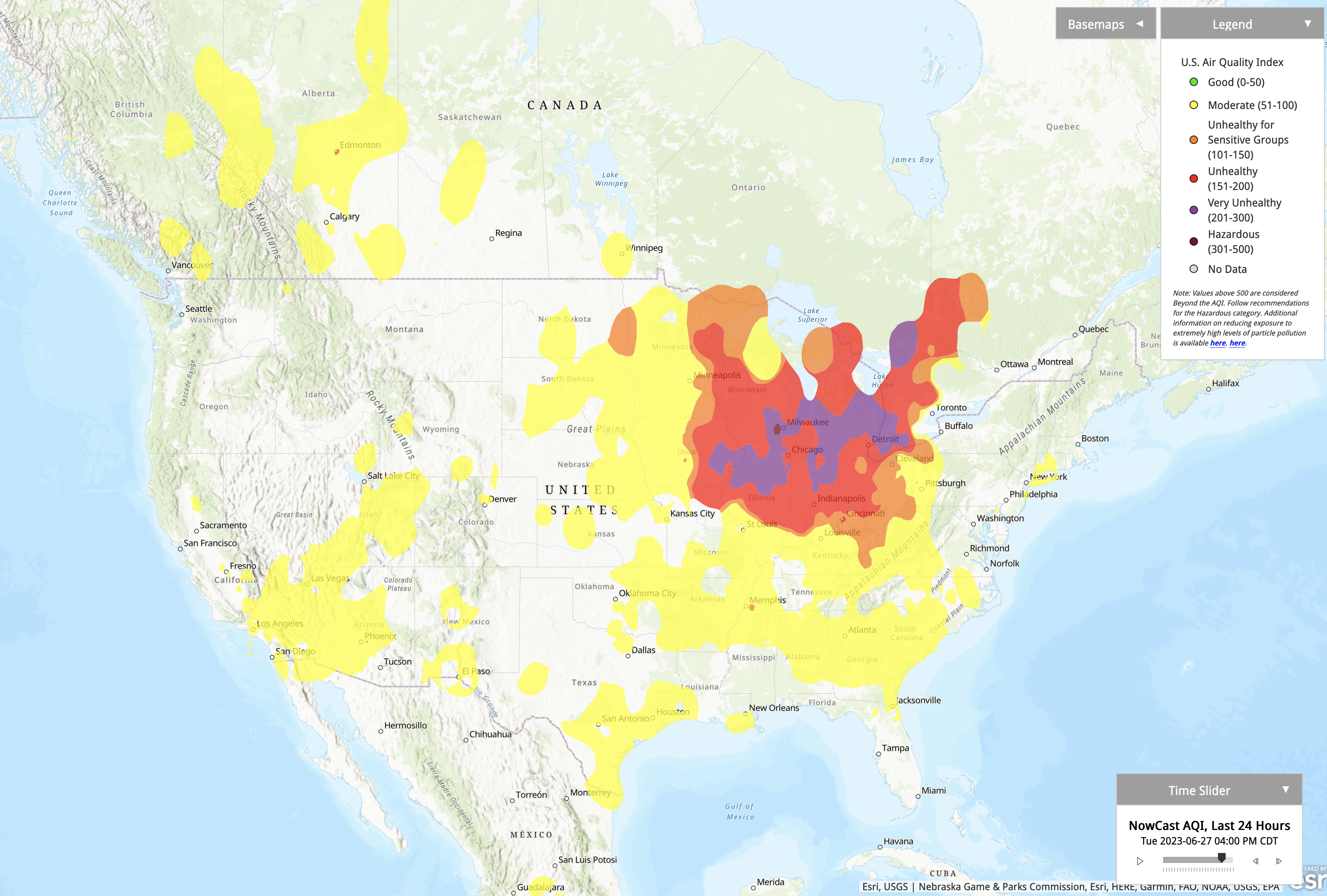
This prevailing atmospheric circulation pattern during June was also responsible for episodes of wildfire smoke from Canada that affected the entire northeastern quarter of the U.S. By far the worst instance occurred during the final week of the month, when high concentrations of smoke blanketed the Great Lakes region. The EPA's Air Quality Index reached the "very unhealthy" category across parts of Wisconsin, where pollution was worse than in any other place across North America. In fact, the concentration of airborne PM2.5 particles (fine particulate matter with diameters of 2.5 micrometers or less) in both Milwaukee and Madison on June 27-28 reached their highest levels since records began in 1999.
A warm but not hot June
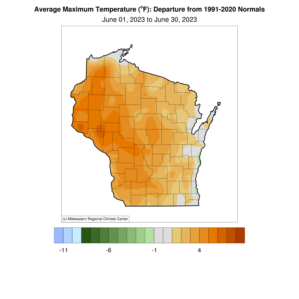
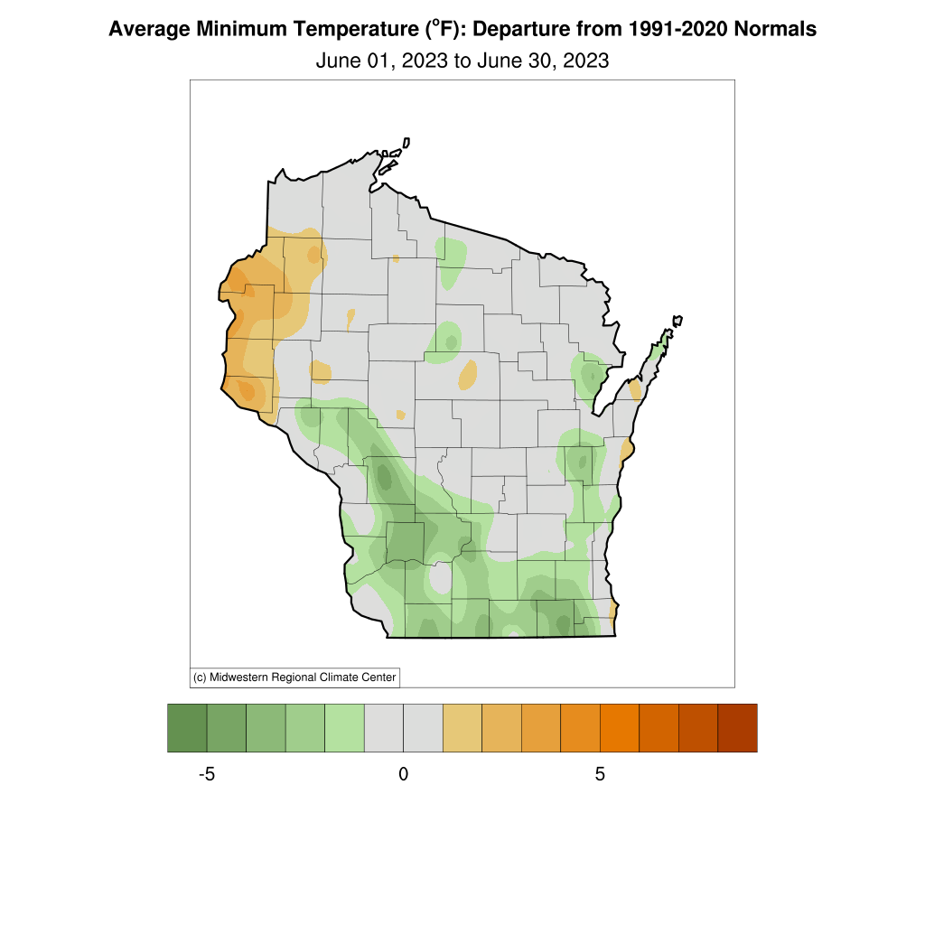
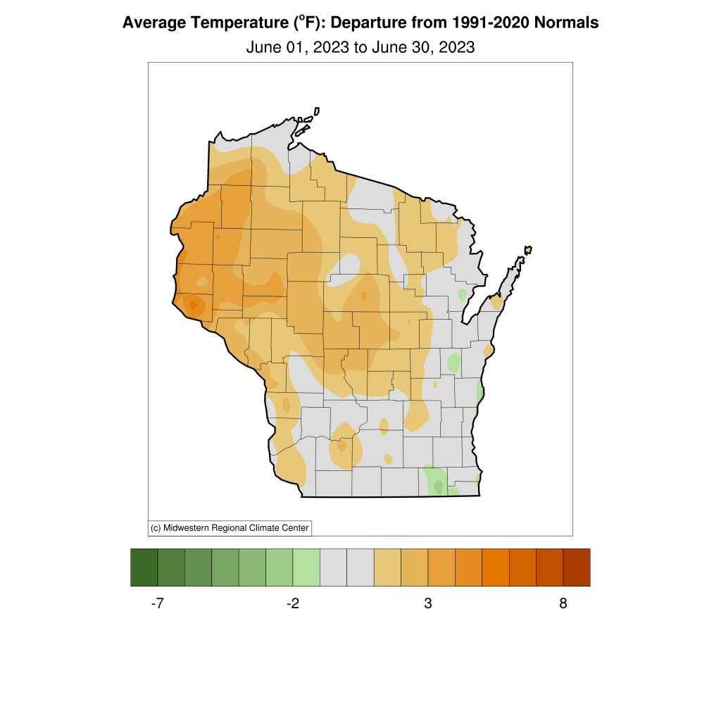
With the drought and smokiness stealing weather headlines last month, temperatures received a lot less attention than usual. However, Wisconsin averaged 66.6°F during June, which is 2.5°F warmer than normal and 21st warmest among all Junes in the 129-year record. The northwest part of the state had the highest daily mean anomalies of more than 3°F. Because dry air favors strong daytime heating and nighttime cooling, June featured a very different temperature story between daytime highs and nighttime lows. As shown below, the vast majority of Wisconsin experienced daily high temperatures considerably warmer than normal, even exceeding 6°F anomalies in places. Statewide, the average monthly daytime high temperature was an impressive 3.7°F above normal, whereas the average nighttime low temperature anomaly was only 1.3°F, and many parts of the state were actually below average.
A silver lining to the drought is that the exceptionally dry air masses during May and June prevented mugginess and thus uncomfortably warm nights. The excellent sleeping weather is reflected by the complete absence this year (through June) of any overnight lows of 70°F or higher at all first-order weather stations in Wisconsin: Milwaukee, Madison, La Crosse, Eau Claire, Wausau, and Green Bay. These oppressive nights can be dangerous for the health of humans and livestock, especially when sandwiched between extremely hot days, so at least the drought hasn't brought all bad news.
|