Wisconsin Climate Watch
March 2023 Wisconsin Climate Summary
Steve Vavrus, PhD, State Climatologist
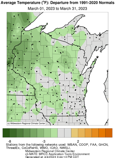
Moderate cold to begin meteorological spring
After a warm start to 2023, March transitioned to a relatively cool month across most of Wisconsin. The 28.7°F statewide average temperature was 1.8 Fahrenheit degrees below the 1991-2020 normal, and all nine climate divisions had negative temperature anomalies. The unusual cold was most pronounced in the northwest, where a persistently deep snowpack remained and helped keep the monthly mean as much as 4 to 5 Fahrenheit degrees below average.
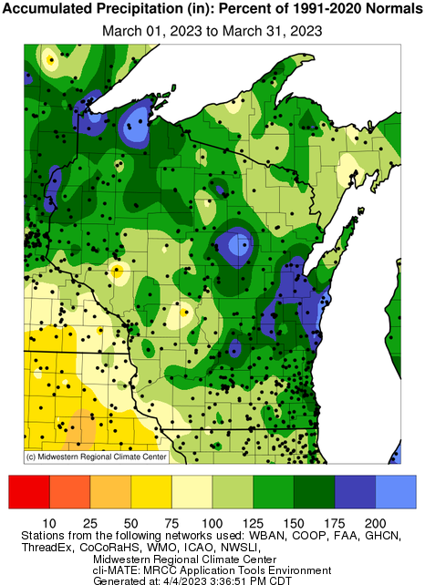
Another wet month
Following Wisconsin's wettest meteorological winter on record, March continued the wet pattern established last November with 0.53 inches more precipitation than normal (+29%). Virtually all portions of the state received more precipitation than average, except for a few scattered regions that reported near-normal amounts. All climate divisions were unusually wet during March, especially the east-central region (54% above normal).
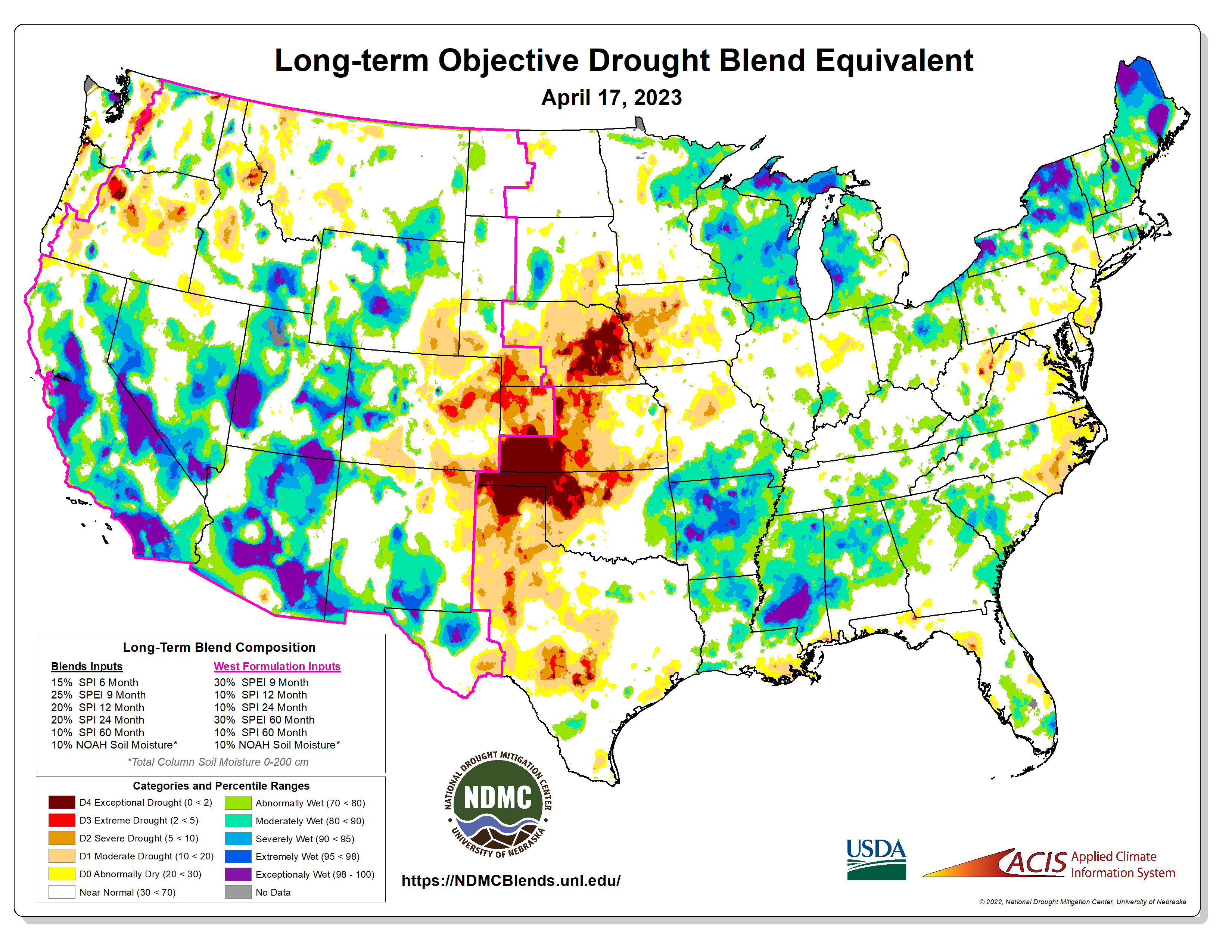
Our prolonged stretch of wet weather has resulted in very moist hydrologic conditions, as reflected by the "Long-term Objective Drought Blend Equivalent" produced by the National Drought Mitigation Center. As of mid-April, the map shows that Wisconsin's accumulated moisture storage is as much as any state, with most of Wisconsin at least "moderately wet" and many places in the "severely wet" or "extremely wet" categories.
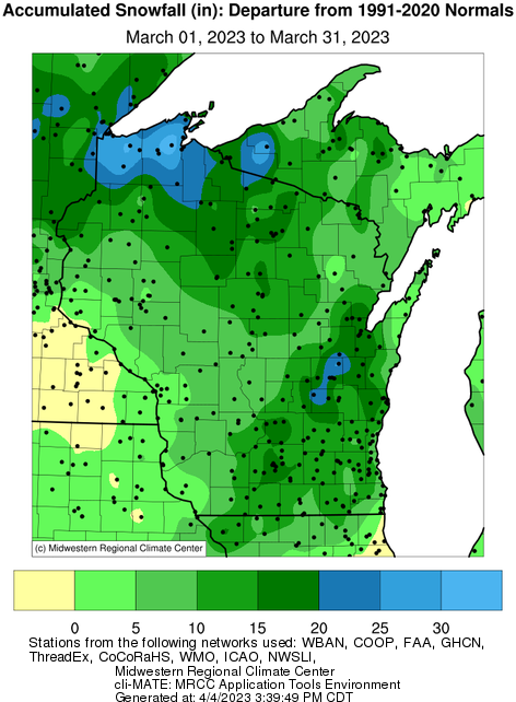
Let it snow!
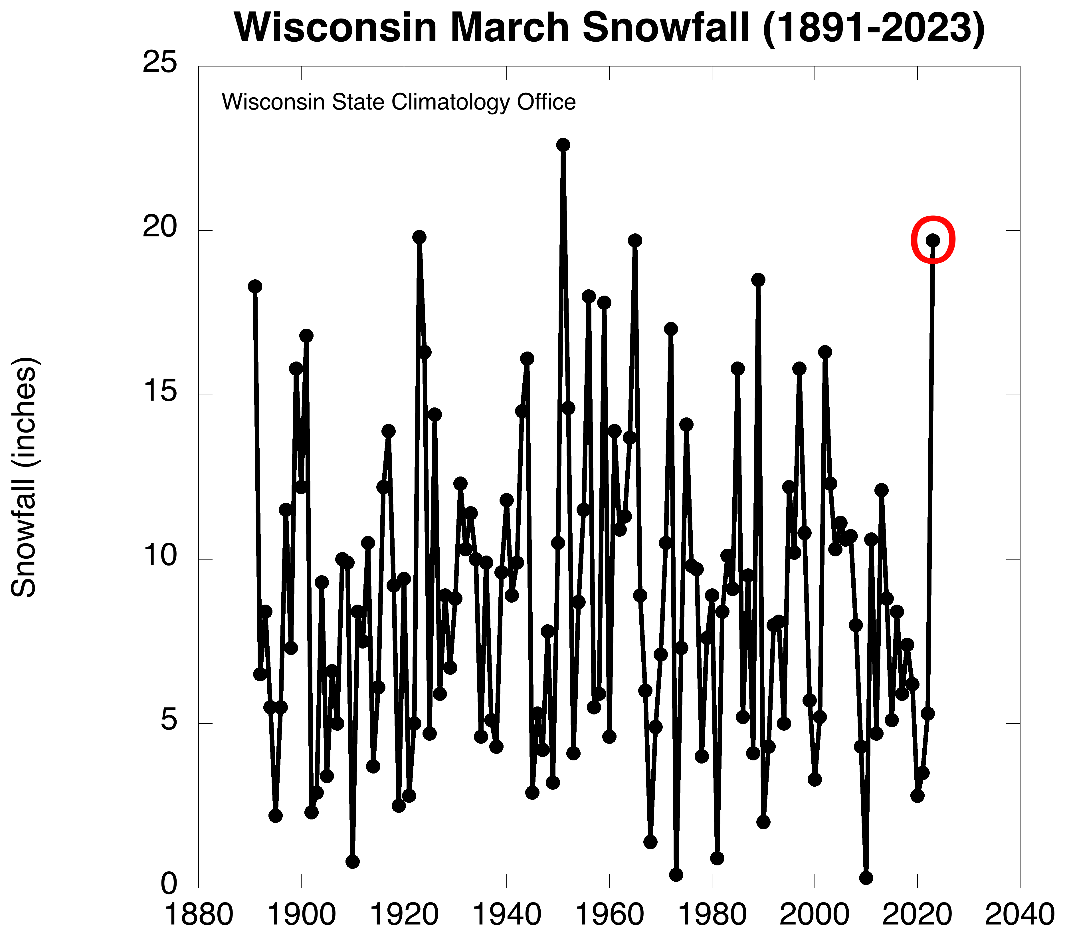
An unusual amount of March's precipitation fell in frozen form. Total snowfall for the month was very high and exceeded normals throughout Wisconsin. Especially heavy amounts fell in the far north, particularly just south of Lake Superior.
To put the snowy month into context, the graph below shows statewide average March snowfall totals back to 1891 and illustrates the high variability: 2010 barely had any measurable snow, while nearly two feet fell during the record high March of 1951. Last month was nearly a record-breaker with 19.7 inches, which was the most since 1965 and tied for the third snowiest March (red circle). Madison even recorded its snowiest March day in history on the 25th, when 12.1 inches fell at the Dane County Regional Airport.
|