|
Energy & Climate
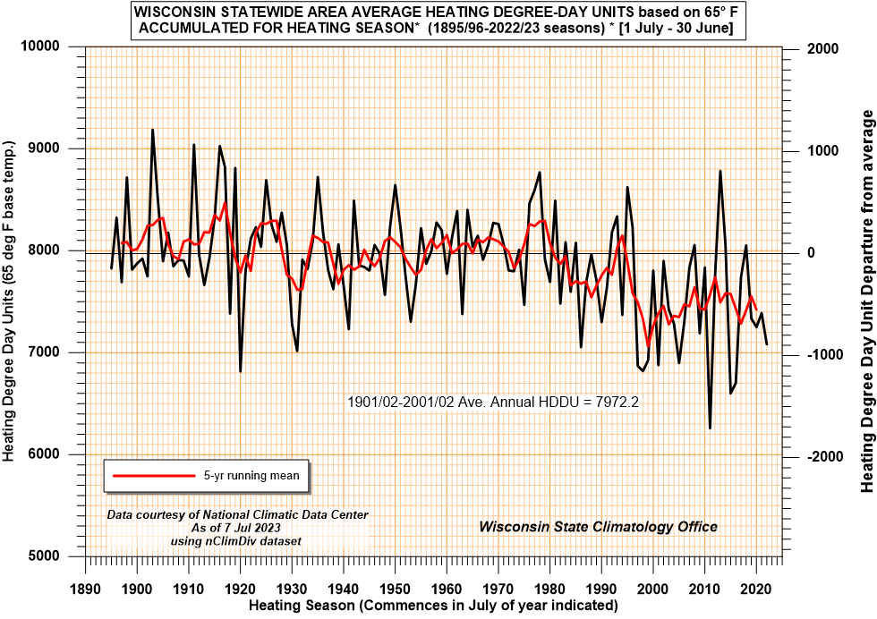
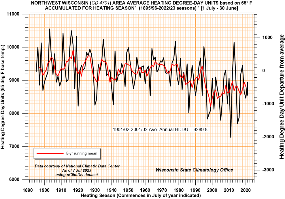
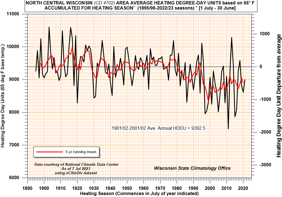
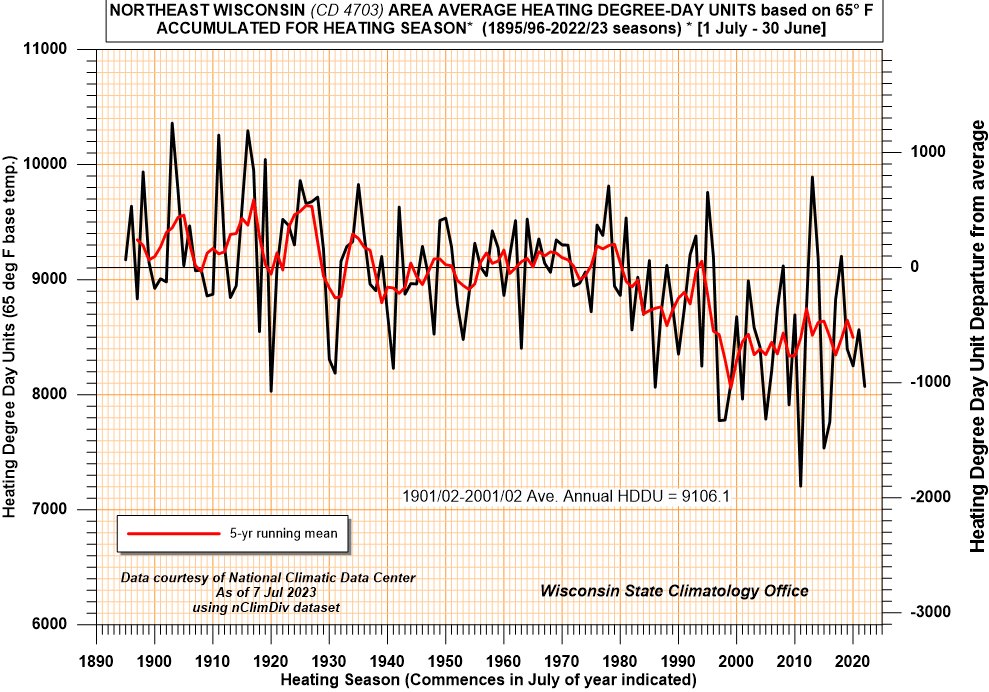
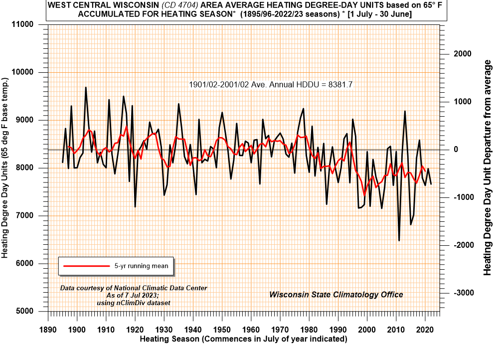
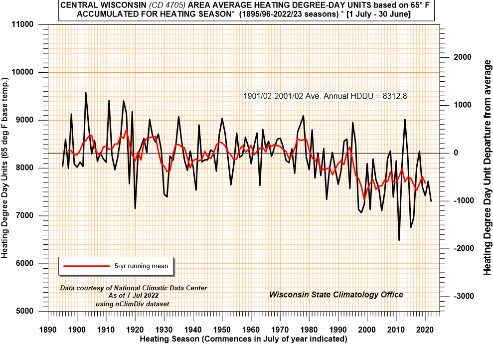
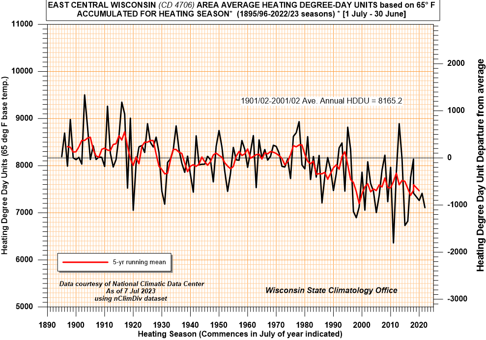
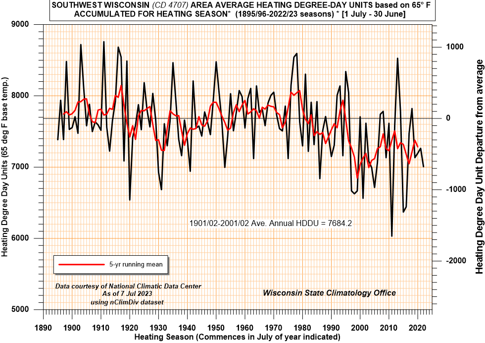
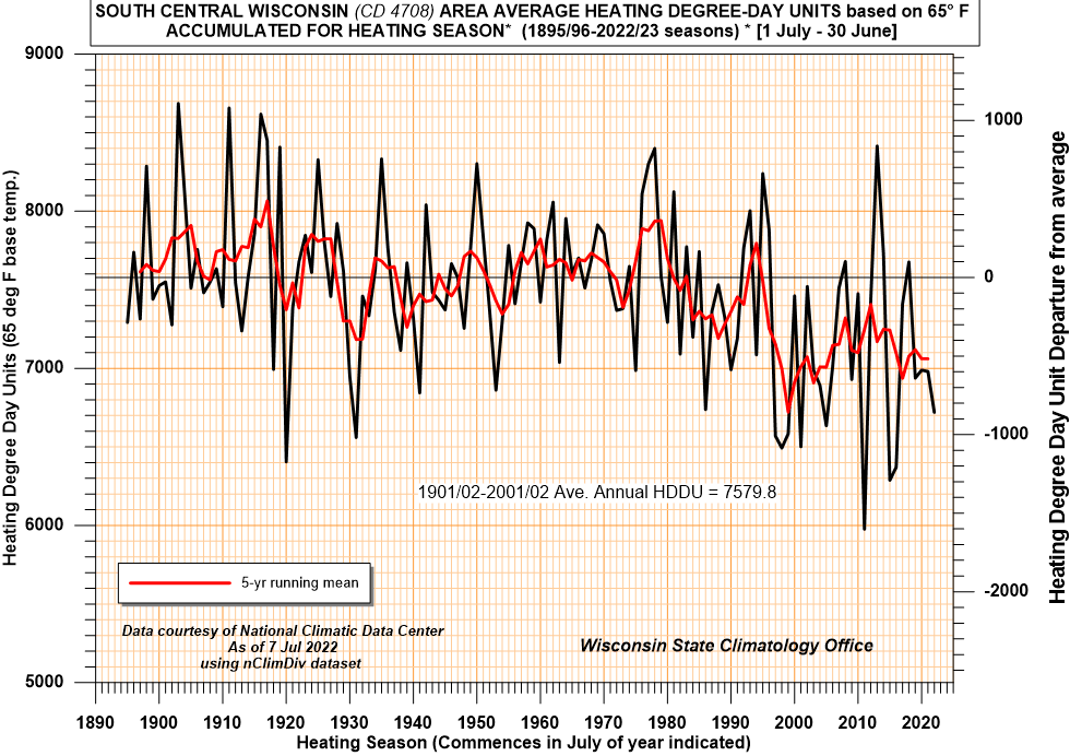
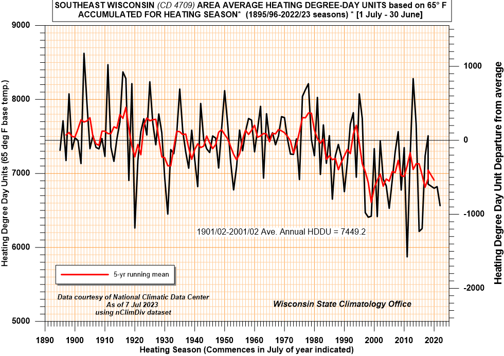
Heating Season
- The heating season is defined from 1 July through 30 June of
the following year to capture the entire season when spacing
heating would occur.
- A heating degree day unit is used to
estimate energy requirements for space heating and represents
the difference between 65 degrees Fahrenheit and the daily
average temperature.
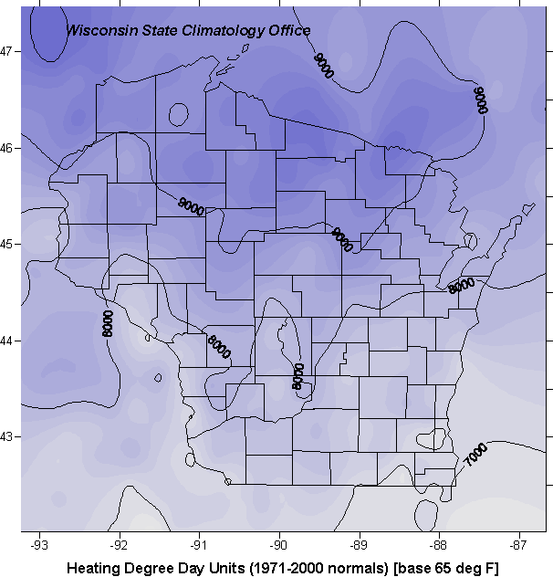
- Heating Degree Data for Major Wisconsin Cities:
- From Climate Prediction Center (CPC)
- State Map of Heating degree day units
(1971-2000 normals)
- Weekly summaries of total heating degrees by:
- Monthly summaries of total heating degrees by:
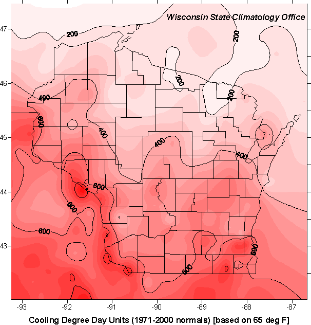
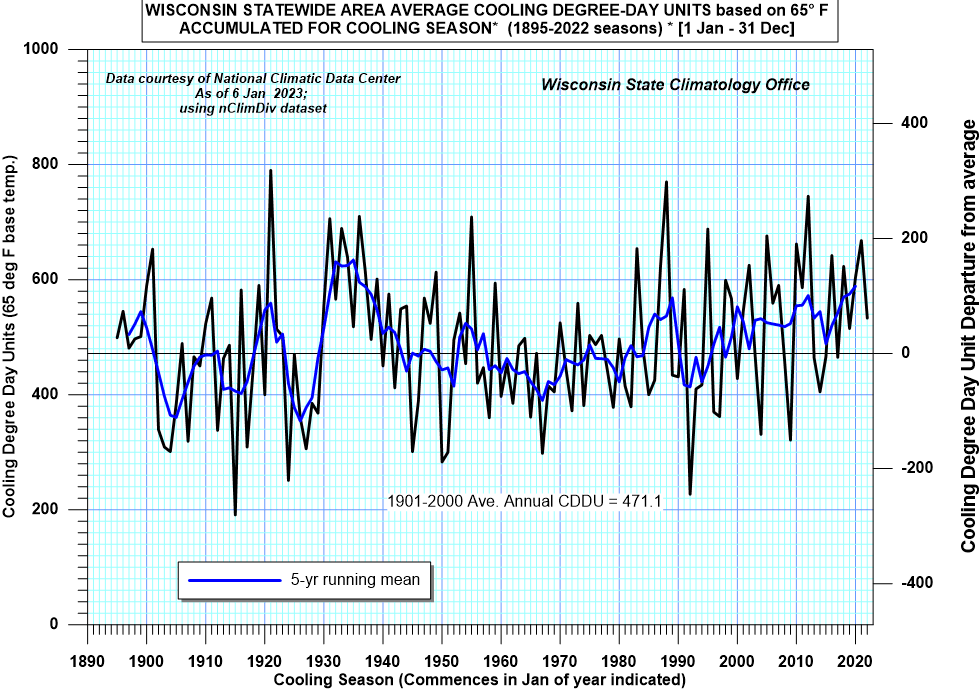
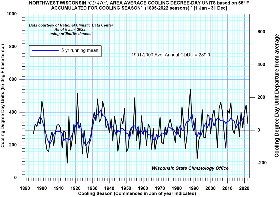
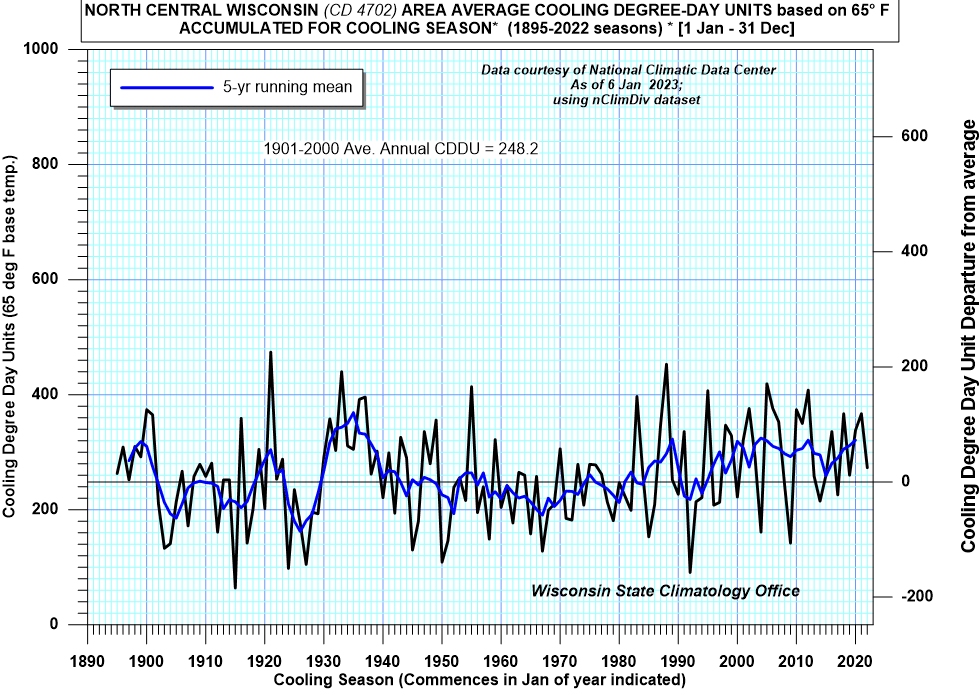
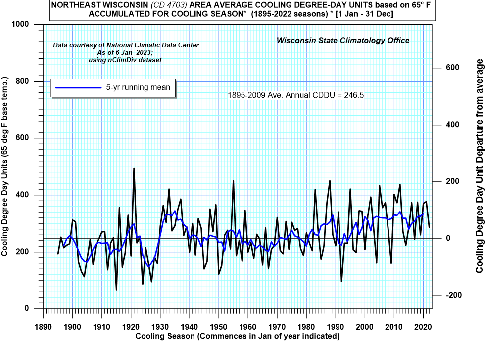
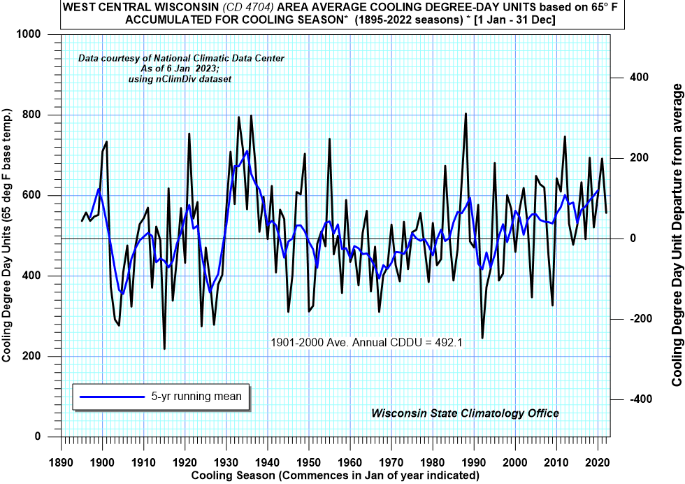
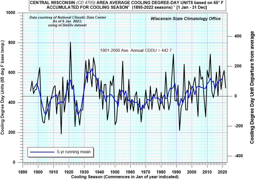
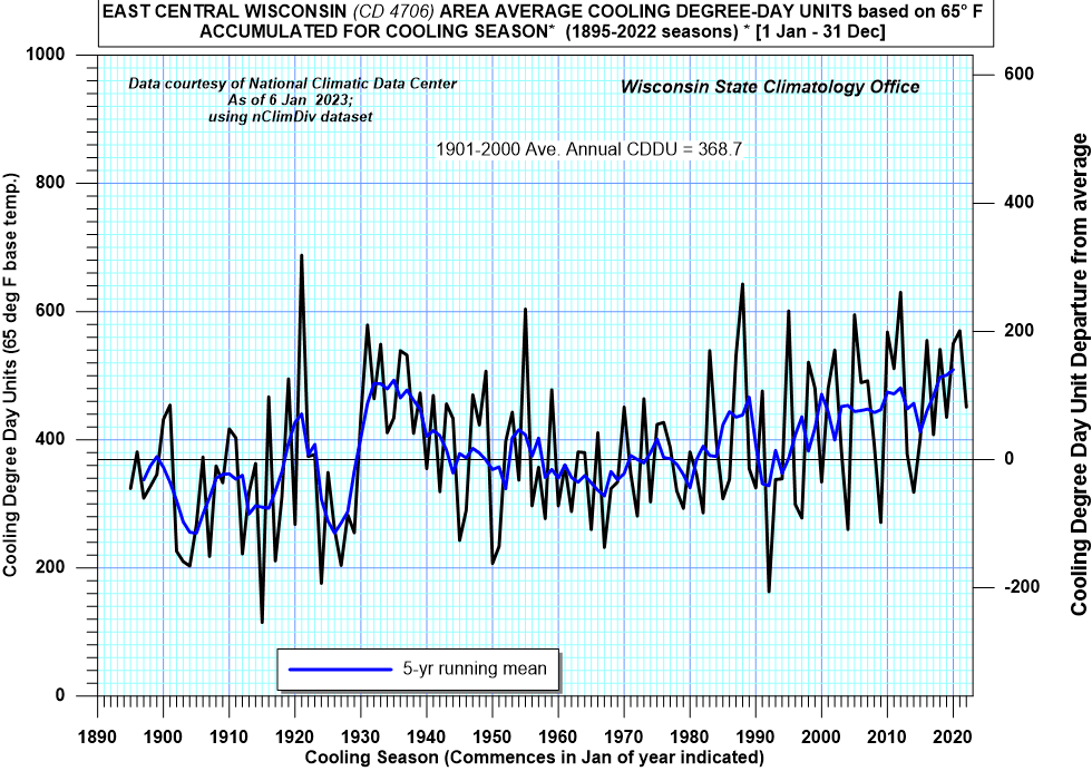
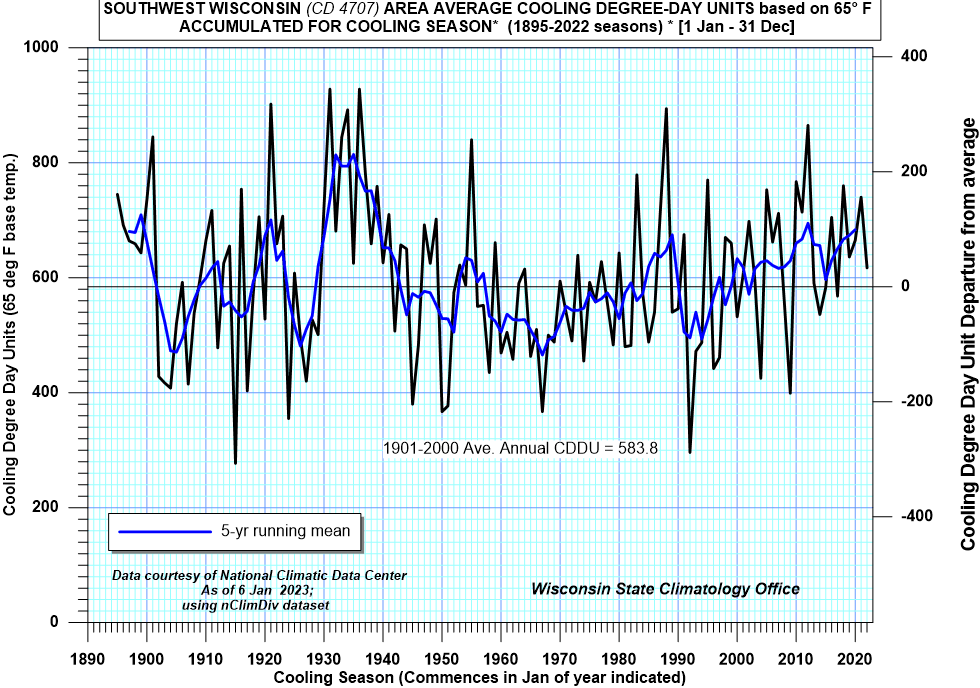
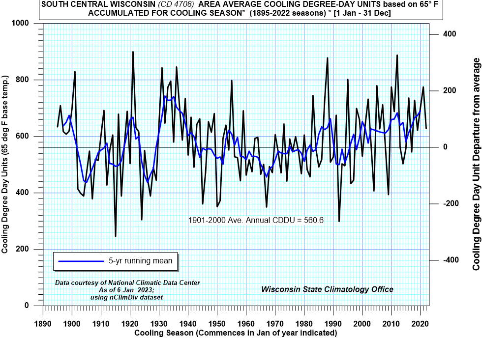
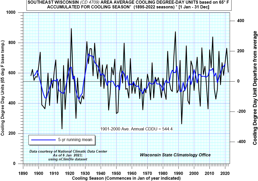
Cooling Season
- The cooling season is defined from 1 January through 31
December to capture the entire season when spacing heating would
occur.
- A cooling degree day unit is used to estimate energy
requirements for air conditioning and represents the difference
between the daily average temperature and 65 degrees Fahrenheit.
-
State Map of Cooling degree day units (1971-2000 normals)
- Weekly summaries of cooling degree day units by:
- Monthly summaries of cooling degree day units by:
-
Archives of last 3 weeks and last three months of cooling
degree day units
- List of
weekly cooling degree day forecasts by state (from Climate
Prediction Center)
- Cooling Degree Days (base 65F)
Statewide
and:
- From Climate Prediction Center (CPC)
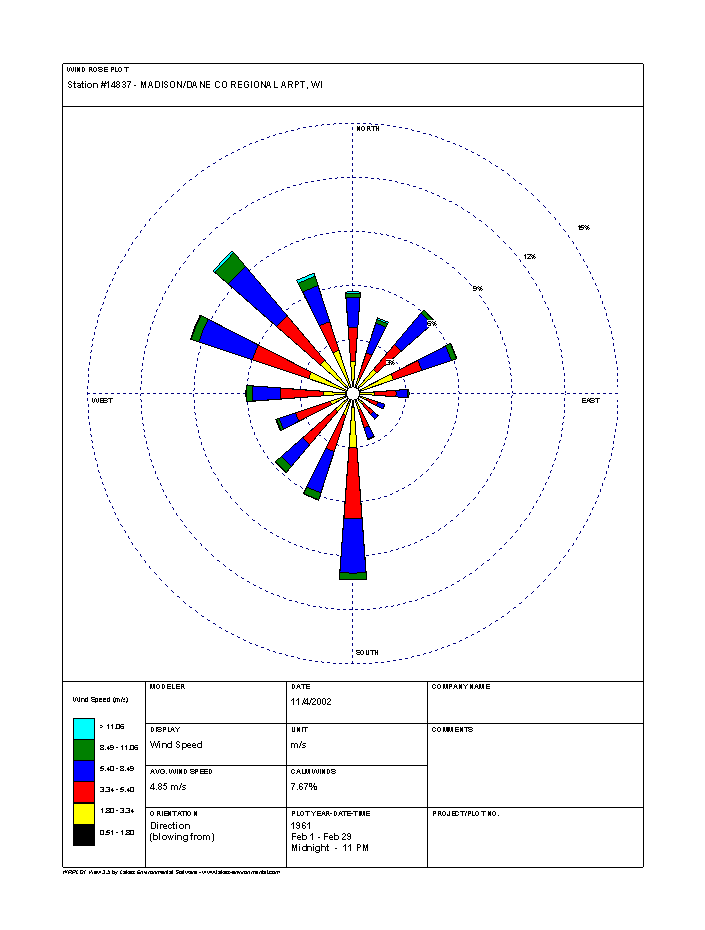
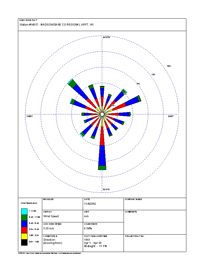
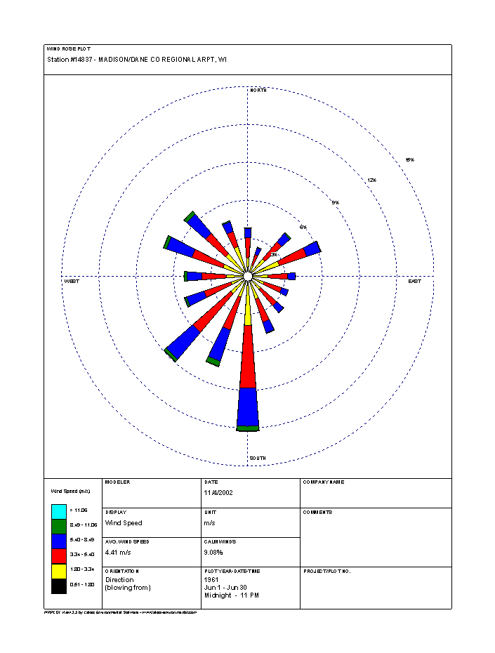
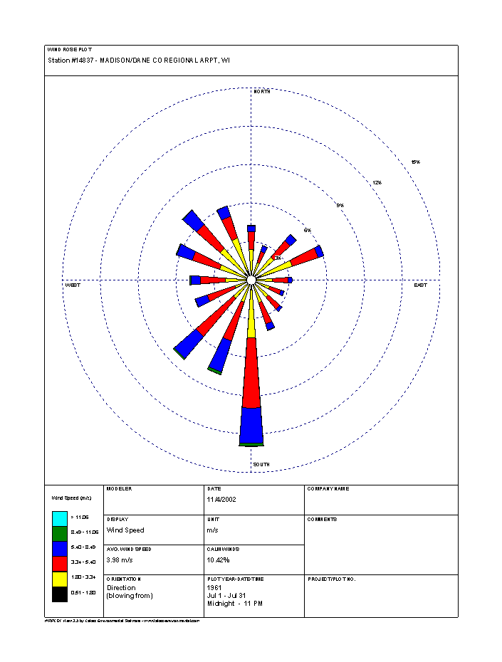
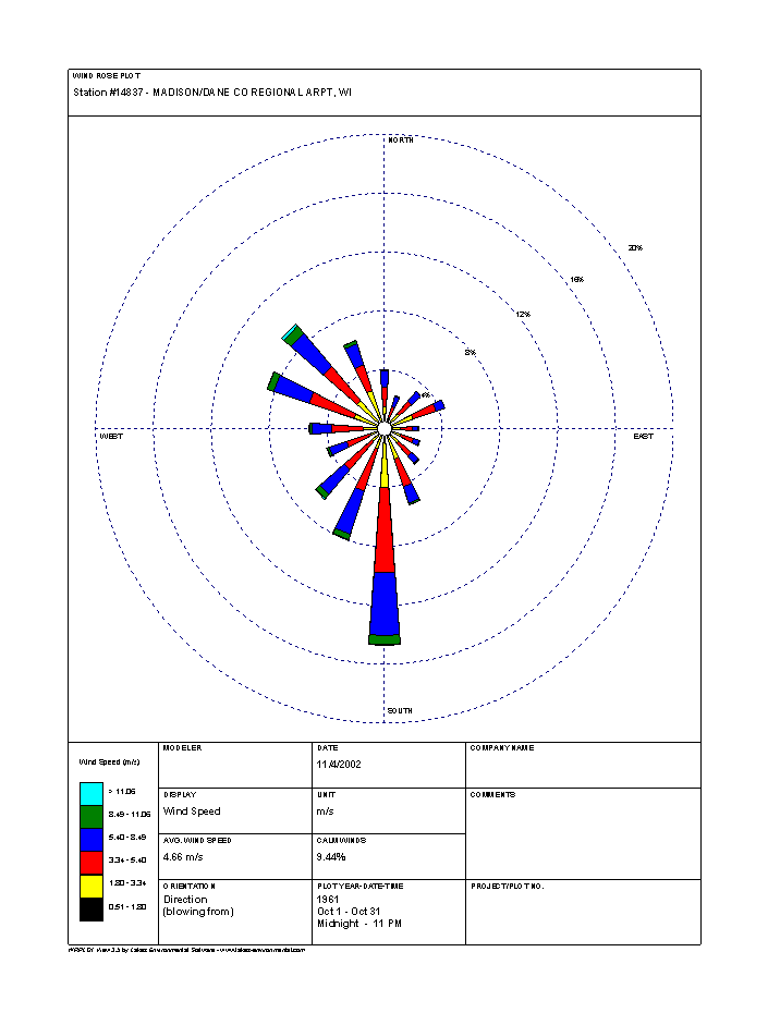
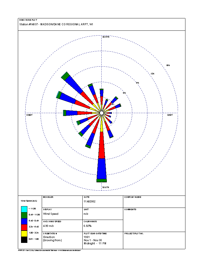
Wind
- Monthly Wind Rose Plots
for Selected Wisconsin Cities
- From Wisconsin ASOS Network on IEM (Iowa Environmental Mesonet) site.
Note: Monthly and annual wind rose plots are available for more than 65 airports across Wisconsin that have automatic weather stations (ASOS or AWOS).
Select "Wind Roses" option for each station to generate plots based on wind data extending back from October 2015 to either 1970 or to beginning of station's period of record.
Select "Custom Wind Roses" to generate plots from user-specified time spans.
- From USDA's NRCS
(National Resources Conservation Service)
- Description of NRCS
wind rose diagrams
(wind vector probabilities)
- Wind Rose Diagrams for Wisconsin (1961-1990 interval)
- Entry for
NRCS wind rose diagrams for other states (1961-1990)
- "Wind atlas of Wisconsin"
Citation: Knox, Pamela Naber, 1996: "Wind atlas of Wisconsin." Bulletin 94 Wisconsin Geological and Natural History Survey, University of Wisconsin-Extension. vii, 47 p. : ill. ; 29 cm.
URL to cite for this work: https://digital.library.wisc.edu/1711.dl/EcoNatRes.WGB94
https://www.aos.wisc.edu/oldsco/publications/Wis_Wind_Atlas_Knox-1996.pdf
- Annual Wind Data Maps for Wisconsin
From:
- Wisconsin Wind Information Center (RENEW Wisconsin)
Wisconsin wind maps produced in 2007 for hub heights of
30 meters, 40 meters, 60 meters, 70 meters and 100 meters
- U.S. Department of Energy's Wind Program and the National Renewable Energy Laboratory (NREL)
Maps of Wisconsin annual average wind speed at
- Wind Energy Resource
Information National Renewable Energy Lab (NREL)
Solar Energy
- UW Extension Ag Weather
- Solar
Resource Information National Renewable Energy Lab (NREL)
- Focus on Energy
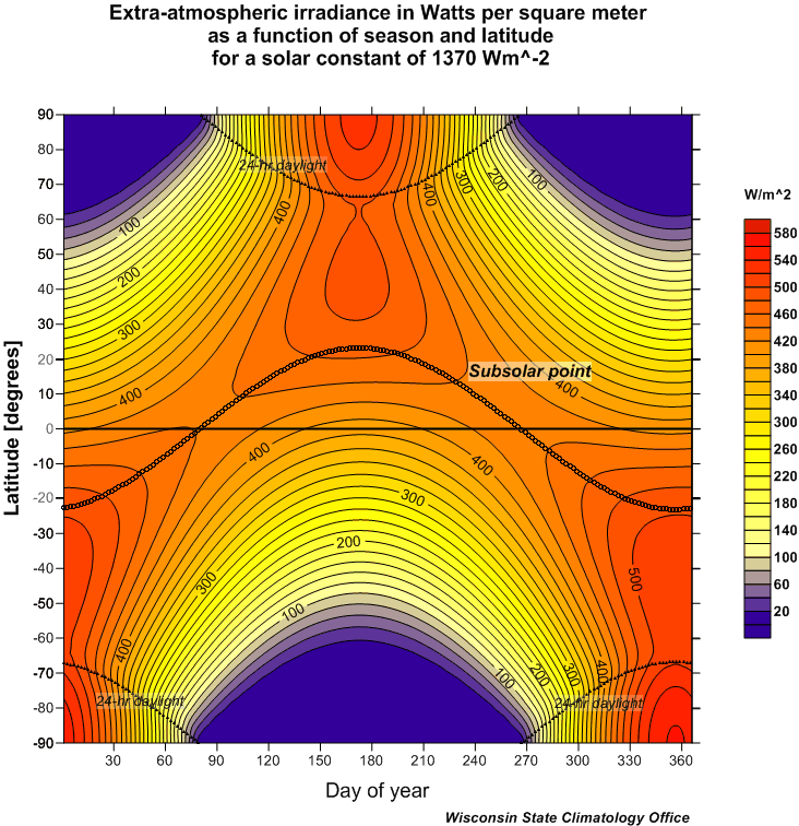
- Extra-atmospheric irradiance information
Plot of
average irradiance as a function of season and latitude (in
W/m2) -
From "A First Course In Atmospheric Radiation," by
permission and courtesy of Prof. Grant Petty (Dept. of Atmospheric
and Oceanic Sciences, UW-Madison)
Plot of
average irradiance as a function of season and latitude (in
W/m2)
Plot of
insolation for the solstices and equinoxes as a function of
latitude (in W/m2)
-
Solar Position Calculators listing
on NREL site
- US Naval Observatory
Other Energy Information
|
|
|
|