|
Wisconsin Summer Climate
(June, July, and August)
News/Events/Other
- Be aware of summertime hazards:
- Heat waves can be deadly even in Wisconsin, claiming more lives during the last two decades than any other weather-related event.
Wisconsin Heat Awareness Day
will be observed on Thursday, 13 June 2013.
- Wisconsin, along with the rest of the nation, observes
Lightning Awareness Week from 23 to
29 June 2013.
- Since Wisconsin borders on two of the Great Lakes, rip currents can pose a hazard to swimmers. The National Weather Service Offices in the Great Lakes States have joined with those along the Atlantic, Gulf and Pacific coasts in issuing rip current threat information when appropriate. The Milwaukee-Sullivan Forecast Office
will participate in Rip
Current Awareness Week (2-8 June 2013).
- Many related graphs and links may be found below and on the Climate Watch and Climate Impacts pages.
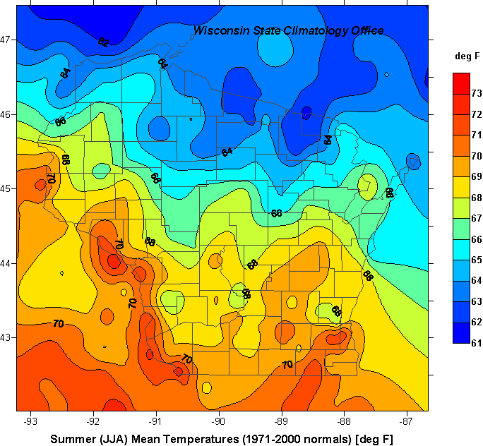
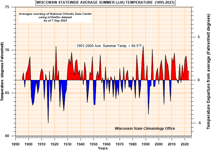
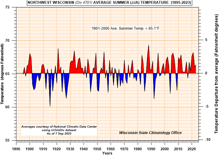
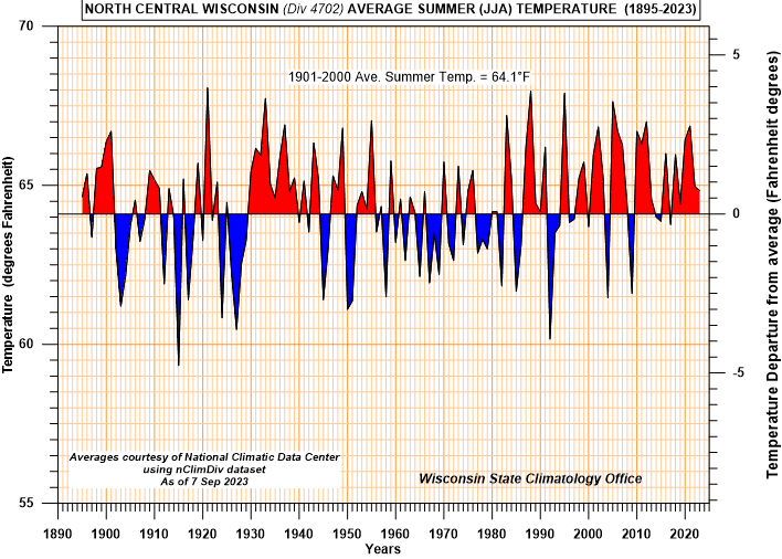
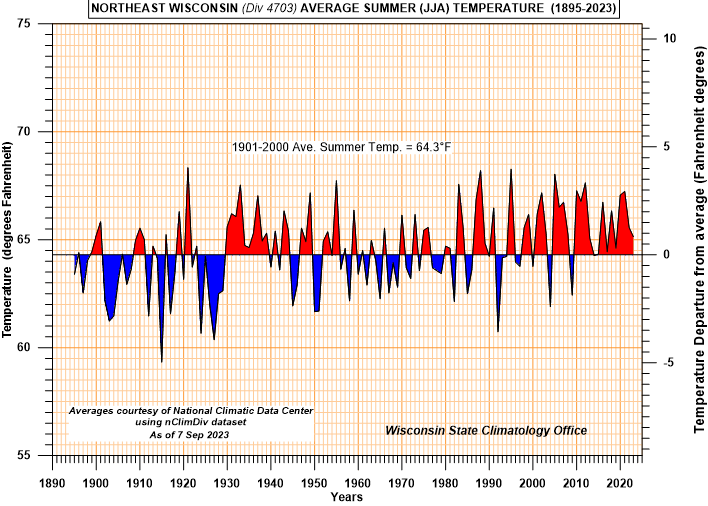
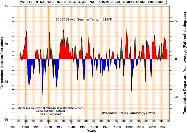
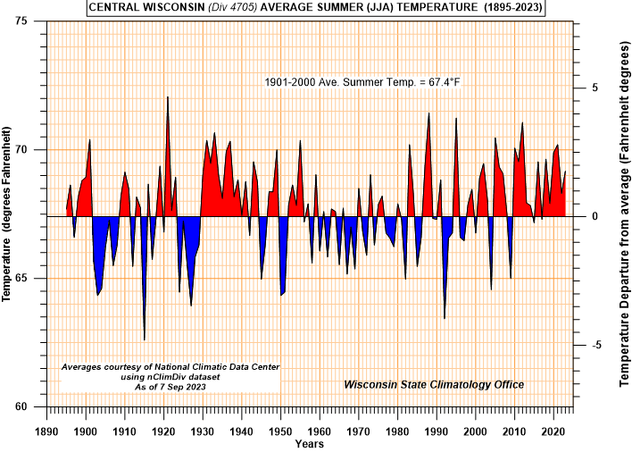
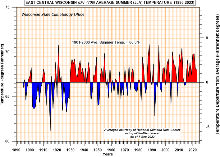
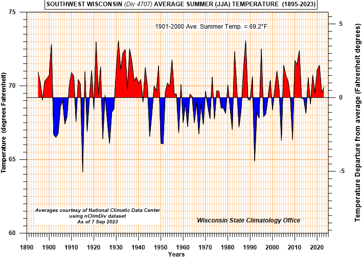
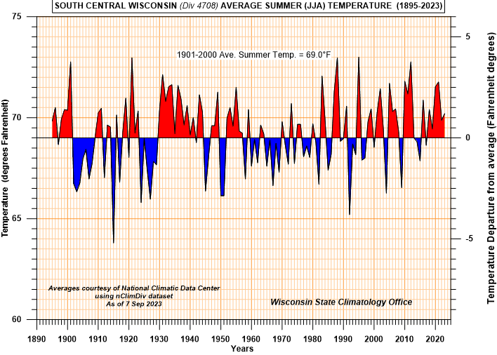
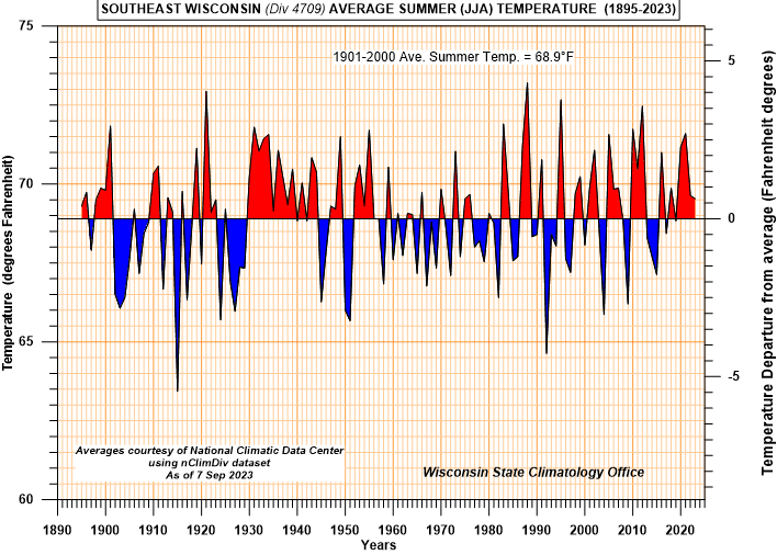
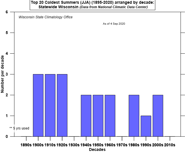
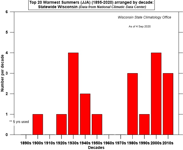
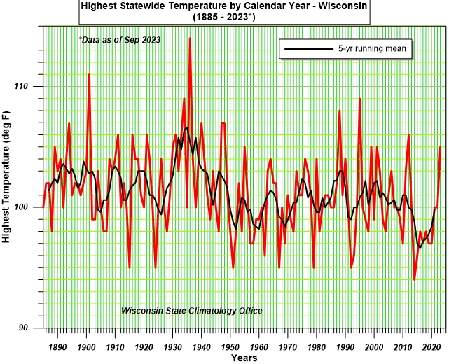
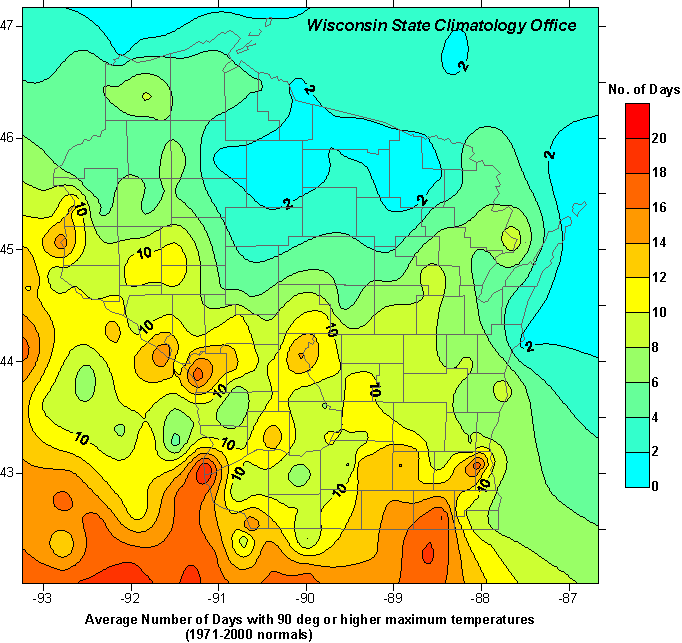
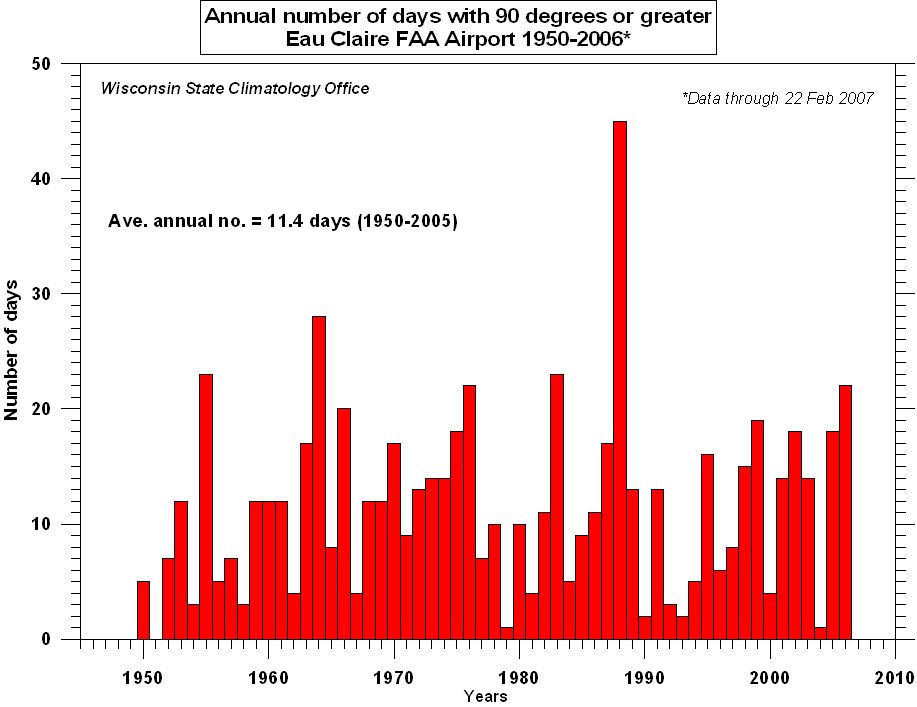
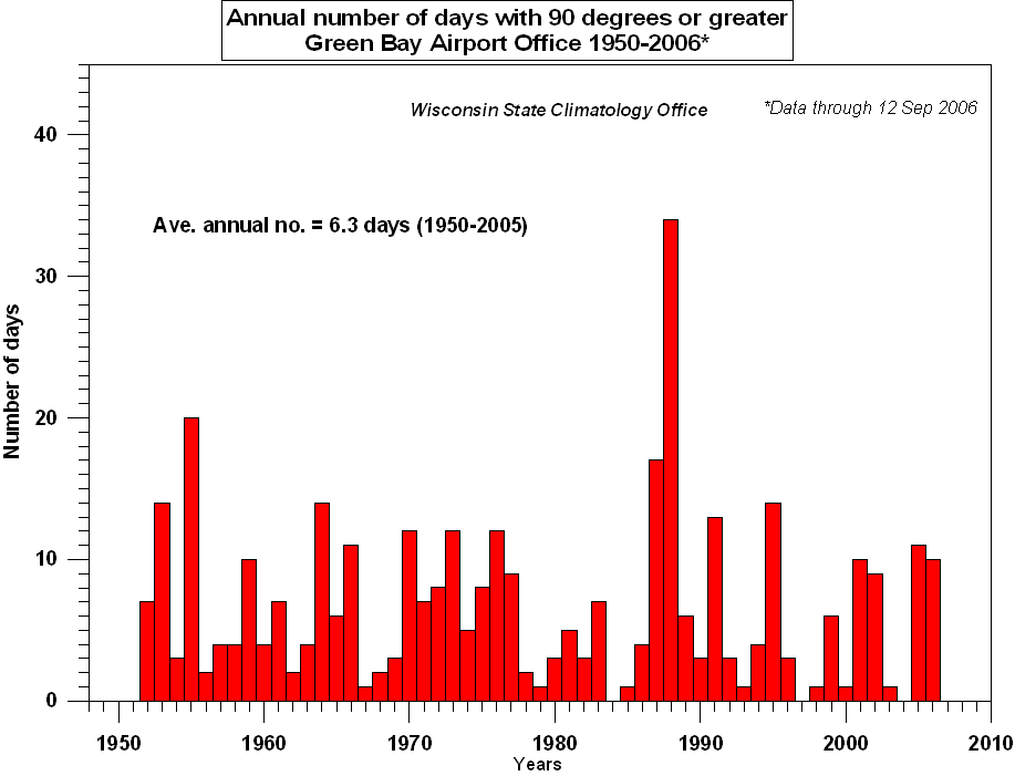
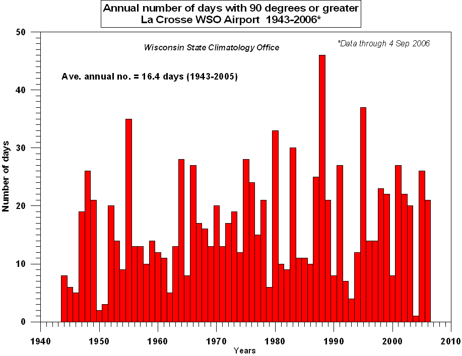
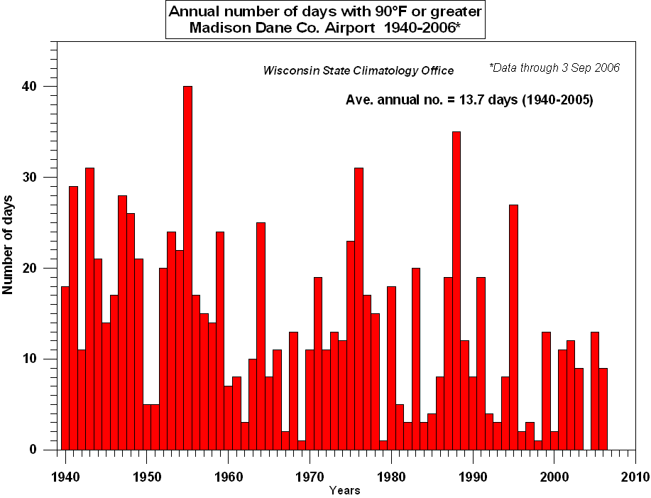
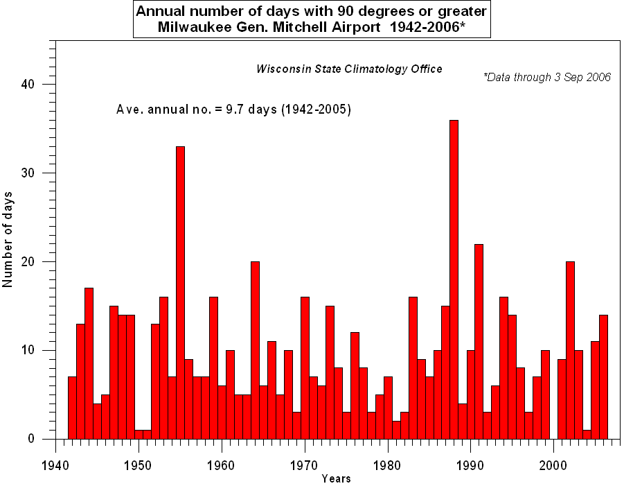
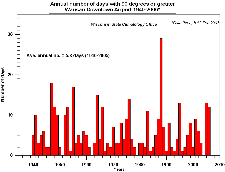
Temperature
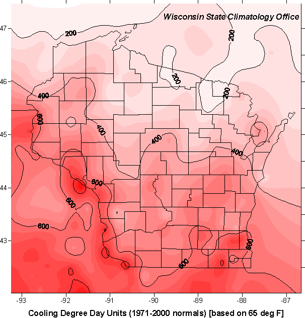
Cooling Degree Days
A cooling degree day unit is used to estimate energy requirements for air conditioning and represents the difference between the daily average temperature and 65 degrees Fahrenheit.
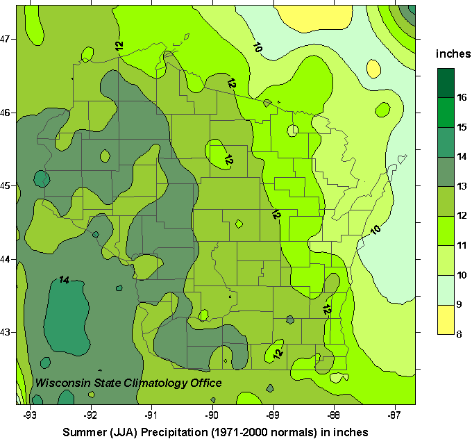
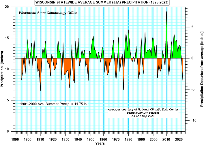
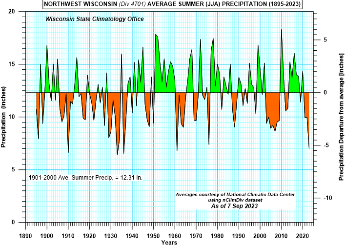
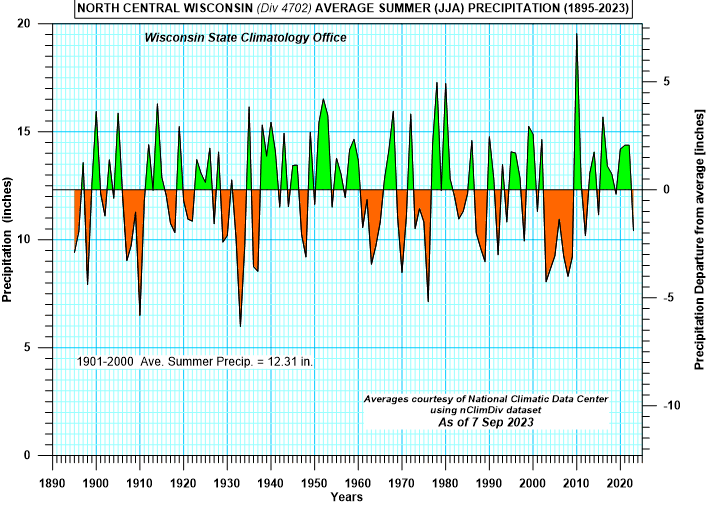
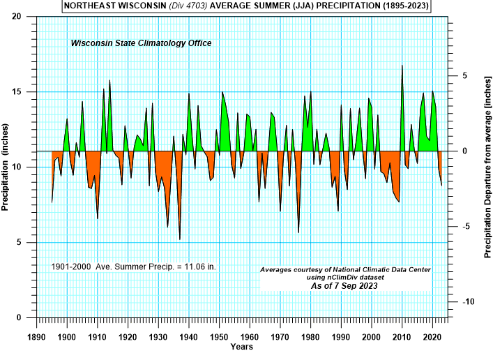
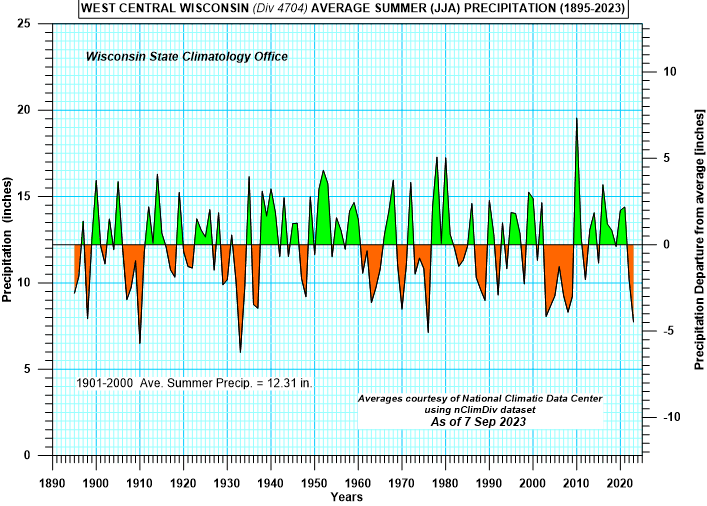
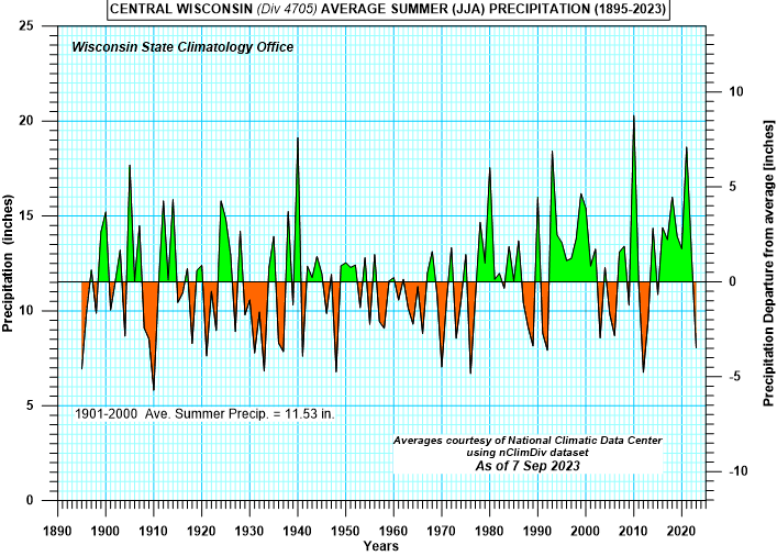
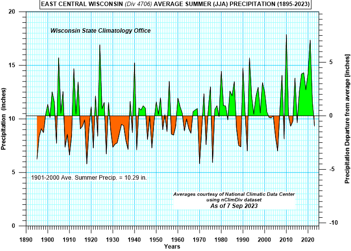
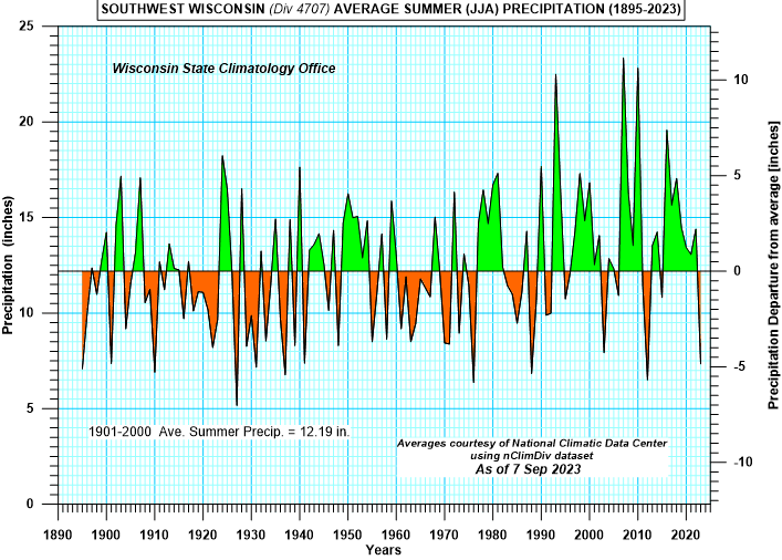
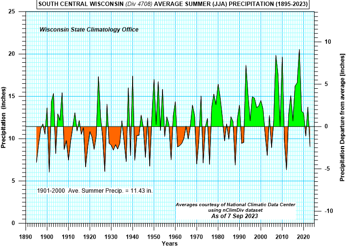
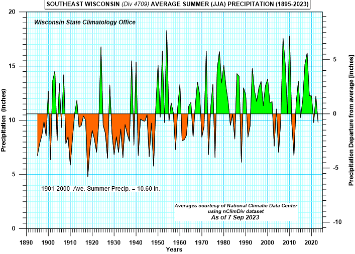
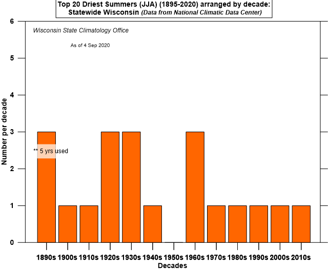
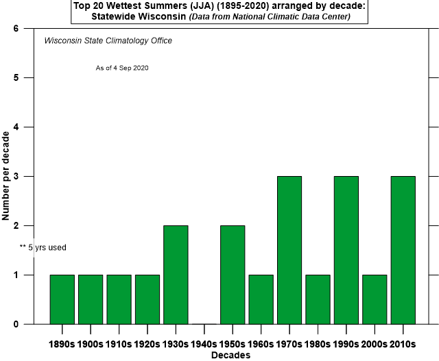
Precipitation
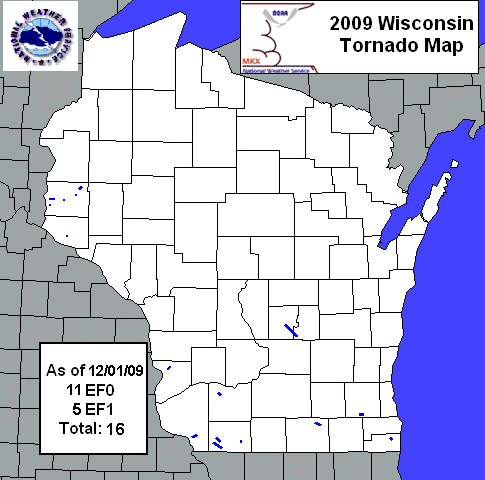
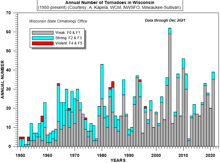
Severe Weather
Heat Stress - Heat index chart from National Weather Service
Heat Stress Safety Tips from NWS including graph of U.S. Pediatric Vehicular Heatstroke Deaths since 1998
-
Heat stress charts for animals
from Iowa State University
- Interactive weather calculator from MRCC for Heat Index calculations
-
Heat
Index Climatology for the North Central States
by Todd Rieck, NWSFO, La Crosse
(A 14-page pdf file, including maps and tabulated data)
- Heat Index Climatology Interactive Map from MRCC
Long-term average values of the days and hours for area stations from the Rocky Mountains to the East Coast, where the Heat Index equals or exceeds threshold values ranging from 80°F to 115°F. Monthly and annual averages are available. [MRCC GIS Maps] (NOTE MRCC also has a selection of analyzed maps of the states to the east of Rockies that show the spatial distributions of calendar year totals of the average number of days with at least one hour with Heat Index readings exceeding specified threshold readings or for days with three or more hours with similarly specified heat index thresholds.)
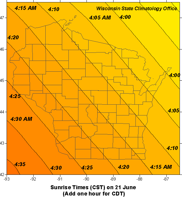
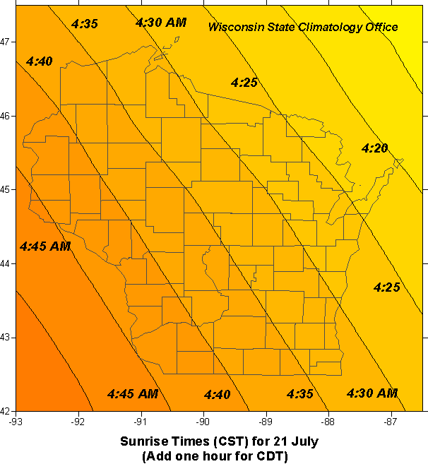
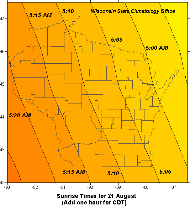
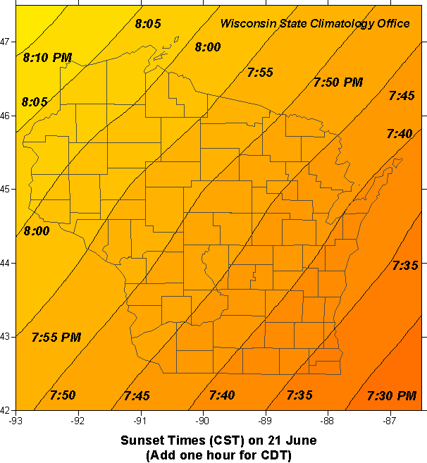
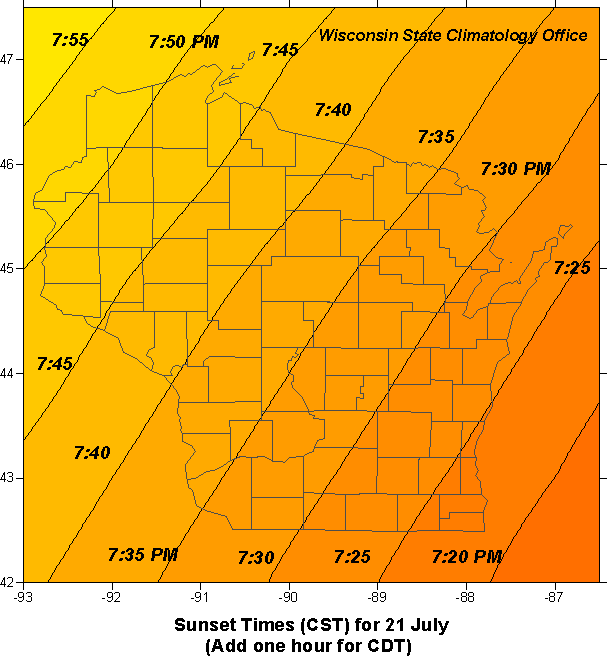
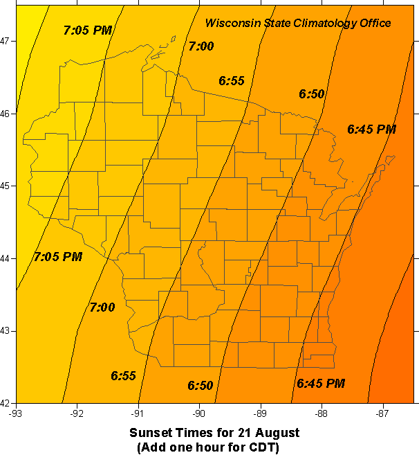
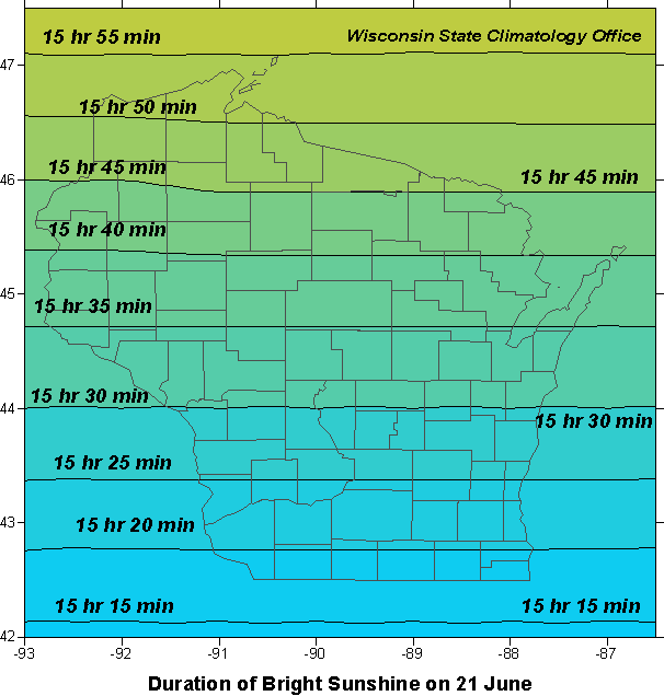
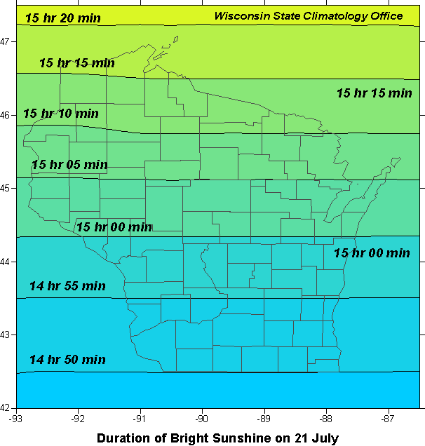
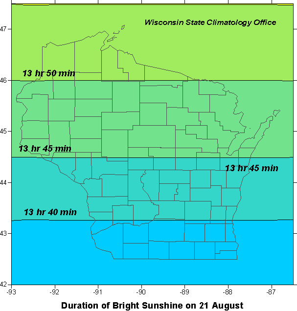
Sunrise/Sunset
Holidays
|
-->
